
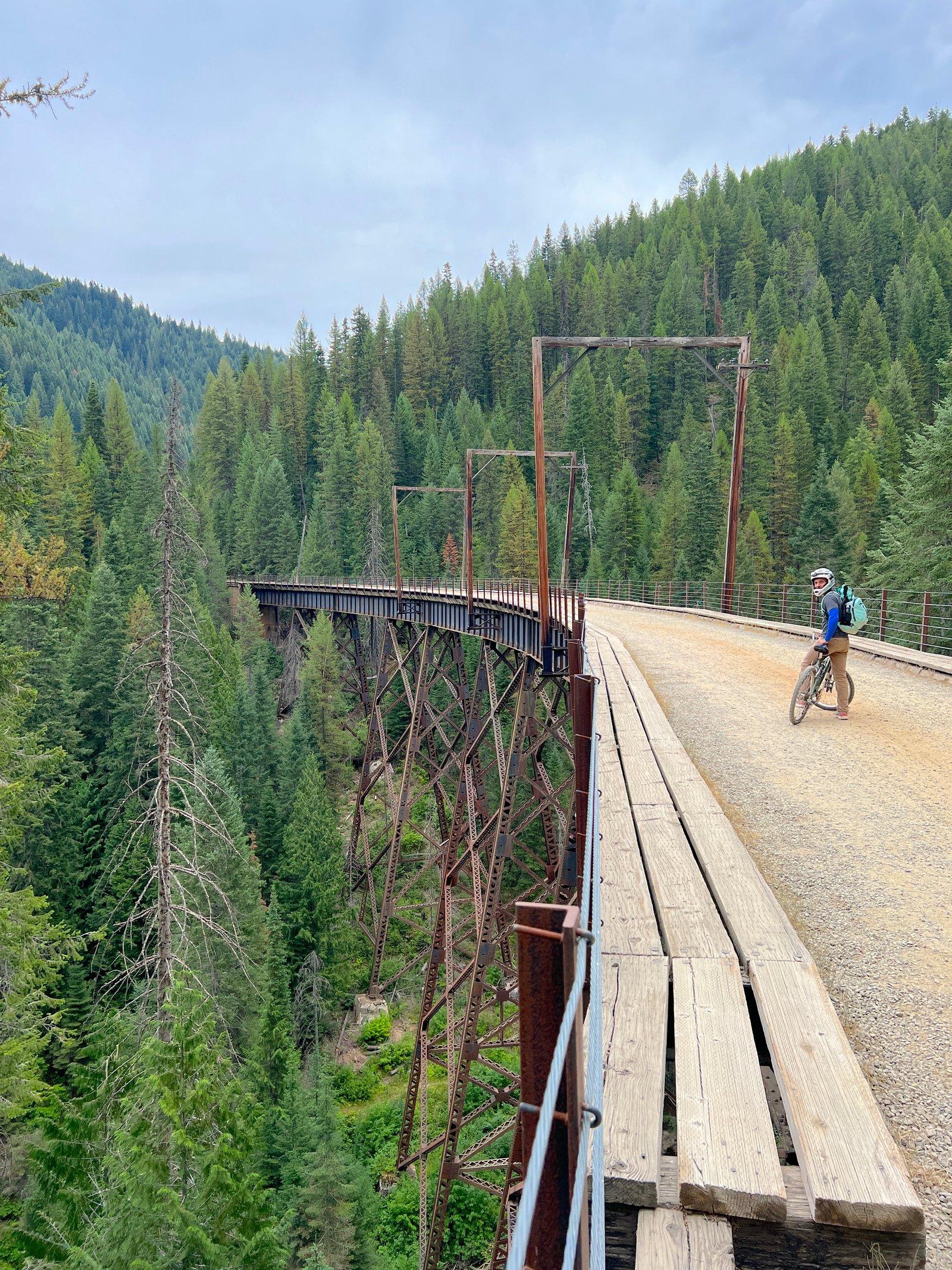
The Route of the Hiawatha is widely considered one of the most scenic bike trails in the Pacific Northwest. Stretching 15 miles along the Idaho–Montana border, this legendary rail-trail features 10 pitch-black railroad tunnels (including the famous 1.6-mile Taft/St. Paul Pass Tunnel) and 7 sky-high trestle bridges spanning forested mountain canyons.
Because the entire trail follows a gentle 1.7% downhill grade, it offers a low-effort, high-reward ride. Even as non-bikers, Mike and I had an amazing and thrilling experience cruising through the dark tunnels, soaking up the sweeping mountain views, and stopping at every scenic overlook along this historic, one-of-a-kind route.
That said, navigating the pitch-black tunnels, securing trail passes, and coordinating the return shuttle require a little advance planning. In this complete Route of the Hiawatha guide, we’ll cover everything you need for a seamless day on the trail—including pass requirements, bike rentals at Lookout Pass, shuttle schedules, tunnel safety tips, and a step-by-step ride breakdown.
Updated for 2026: All ticket prices, operating dates (May 22 – September 20, 2026), shuttle schedules, and trail rules reflect the current season.
This post contains affiliate links, so we may earn a small commission when you make a purchase through links on our site at no additional cost to you.
A Quick Look at What This Guide Includes
- About the Route of the Hiawatha — A quick overview of the trail’s history, location, and what makes it unique.
- Trail Details — Distance, difficulty, elevation, season dates, and essential trail stats.
- Trail & Shuttle Passes — Everything you need to know about pricing, reservations, and required passes.
- Shuttle Information — How the shuttle works, where it picks up, and timing expectations.
- Bike Rentals — Rental options, locations, and what to know before choosing a bike.
- How to Get to the Route of the Hiawatha — Clear directions to each trailhead with drive times.
- What to Expect on the Trail — A preview of tunnels, trestles, terrain, and overall trail flow.
- Best Time to Ride — Seasonal considerations and the ideal time of day for the best experience.
- Tips for Riding the Route of the Hiawatha — Practical advice to make your ride smoother and safer.
- What to Bring — A complete packing list to help you prepare for tunnels, weather, and trail conditions.
- Amenities on the Trail — Restrooms, parking, shuttle stops, and services available at each trailhead.
- Towns Nearby — Nearby towns with lodging, food, and rental options, plus drive times.
- Our Experience on the Route of the Hiawatha — A detailed, photo‑supported play‑by‑play of our ride.
- FAQ — Answers to the most common questions riders have before visiting.
- Helpful Links — Direct links to official sites.
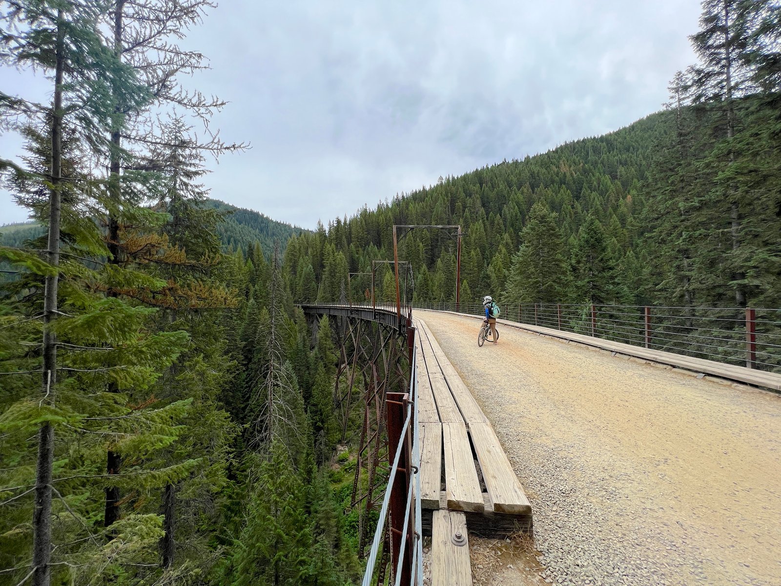
Route of the Hiawatha: Quick Trail Facts
- Location: Bitterroot Mountains (Idaho–Montana border near Lookout Pass)
- Distance: 15 miles one-way (all downhill)
- Grade & Surface: Gentle 1.7% downhill grade; packed dirt & fine gravel
- Key Highlights: 10 dark train tunnels (incl. 1.6-mile Taft Tunnel) & 7 high trestle bridges
- 2026 Season: Open daily: May 22 – September 20, 2026
- Required Gear: High-lumen bike light or headlamp (mandatory for tunnels), helmet, extra layer
- Difficulty: Easy / Beginner-friendly (ideal for non-bikers and families)
About the Route of the Hiawatha
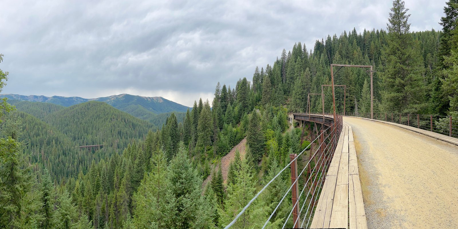
The Route of the Hiawatha is a 15‑mile rail‑to‑trail bike path following the historic Milwaukee Railroad line through the Bitterroot Mountains along the Idaho–Montana border. Operated by the Lookout Pass Ski & Recreation Area, the trail glides gently downhill at a 1.6% to 1.7% grade. Featuring 10 cavernous train tunnels, 7 sky-high trestle bridges, and non-stop mountain vistas, it stands as one of the most unique and scenic bike rides in the United States.
A Brief History: The “Grandest Scenic Route”
This legendary trail was once part of the Milwaukee Road, a transcontinental railroad constructed in the early 1900s connecting Chicago to Seattle. Building this stretch through the rugged Bitterroot Range required over 9,000 workers, two years of hard labor, and roughly $250 million—launching its first intercontinental freight service on July 4, 1909.
Following the devastating Great Fire of 1910 and decades of financial challenges, railroad operations eventually ceased, with the final train rolling through Northern Idaho in 1980. Today, the converted rail-trail preserves that incredible engineering legacy while offering outdoor enthusiasts a thrilling ride through living history.
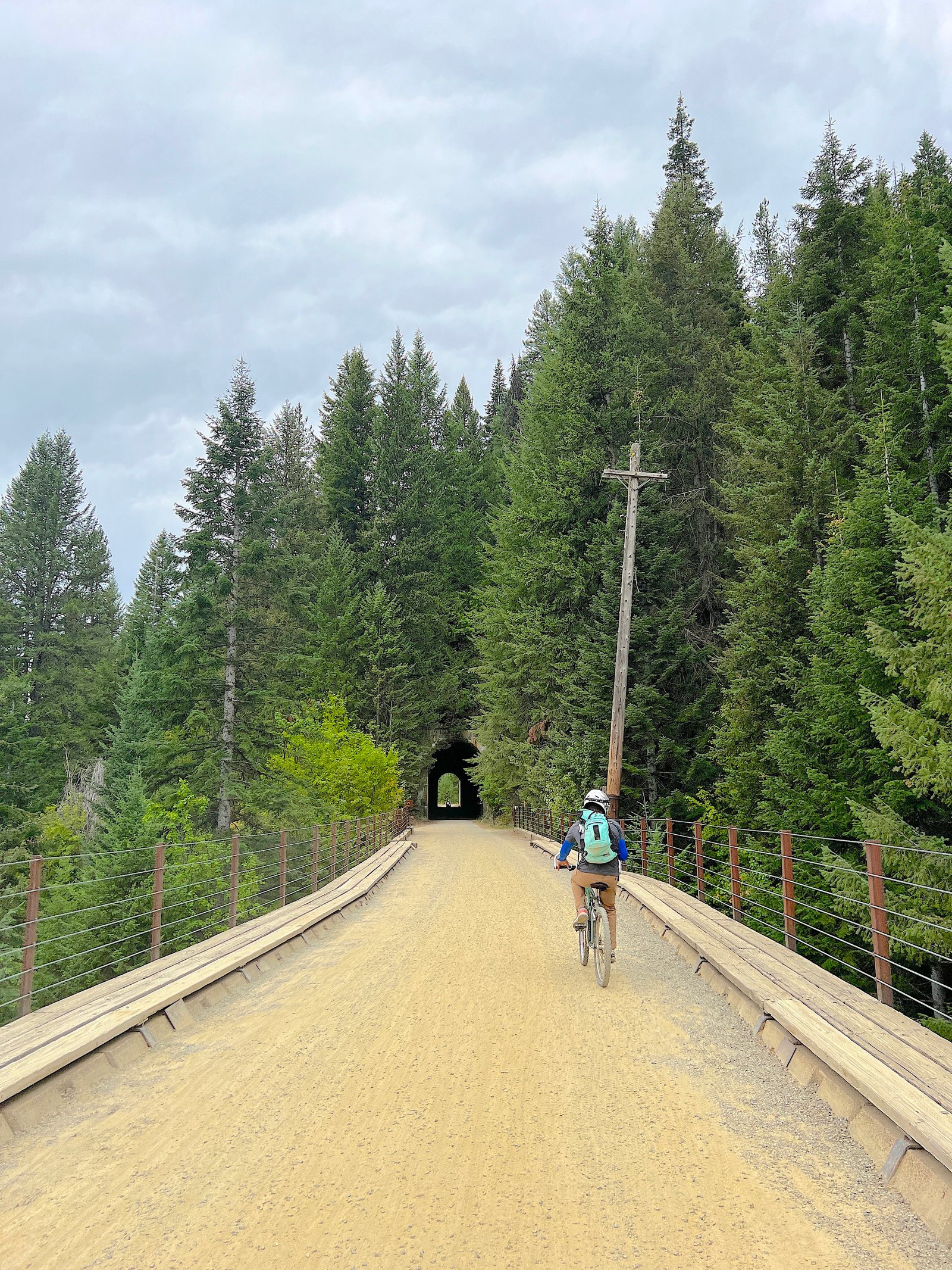
Quick Trail Details & Specifications
- Distance: 15 miles one‑way (continuous gentle downhill from Taft Tunnel to Pearson Trailhead).
- Grade: 1.6%–1.7% downhill—very easy for families, beginners, and casual riders.
- Surface: Packed gravel and dirt. Smooth overall, with occasional loose patches and muddy, wet sections inside the tunnels.
- Key Highlights:
- 10 historic railroad tunnels (including the famous 1.6-mile Taft / St. Paul Pass Tunnel)
- 7 towering trestle bridges spanning deep forest canyons
- Time Needed: 2 to 4 hours, depending on photo stops, breaks, and your comfortable riding pace.
- Trail Direction & Flow: Most cyclists ride top-to-bottom (East Portal/Taft to Pearson) and take the return shuttle back up to the Roland side of the Taft Tunnel. Hardier riders can choose to pedal back up the 15-mile grade.
- Trail Operator: Lookout Pass Ski & Recreation Area (manages trail passes, shuttle operations, and bike rentals).
Trail & Shuttle Passes (2026 Pricing)
All riders are required to hold a valid Trail Pass, and most visitors opt for the Shuttle Pass to avoid pedaling 15 miles back uphill.
Pro Tip: Booking your tickets online in advance through Lookout Pass saves a few dollars per ticket compared to same-day window pricing.
Midweek Pricing (Monday – Thursday)
- Adult Trail Pass (Ages 13+): $20
- Child Trail Pass (Ages 5–12): $15
- Adult Shuttle Pass (Ages 13+): $20
- Child Shuttle Pass (Ages 5–12): $15
Weekend & Holiday Combo Pass (Friday – Sunday)
Weekend tickets are sold as all-in-one Combo Passes that include both your trail access and return shuttle:
- Adult Weekend Combo (Ages 13+): $40
- Child Weekend Combo (Ages 5–12): $30
- Kids 4 & Under: Free trail & shuttle access
Bike Rentals & Equipment Fees
- Standard Rentals: Lookout Pass offers adult ($40–$45) and child ($33–$38) bike rentals that come fully equipped with a helmet and high-lumen bike light.
- E-Bike & Fat Tire Shuttle Surcharge: If you bring or rent an e-bike or fat-tire bike, expect a $10 specialty shuttle fee to haul the heavier frame back to the top.
Shuttle Information & How It Works
Because the Route of the Hiawatha is designed as a continuous 15-mile downhill ride, most visitors take the return shuttle back up to avoid a 15-mile uphill climb. The shuttle system is efficient, accommodating hundreds of riders daily with bike racks attached to buses or trailing trailers.
How the Return Trip Works Step-by-Step:
- Finish at Pearson: Once you reach the bottom at the Pearson Trailhead, follow the signs to the shuttle staging area.
- Load Your Bike: Staff members help load your bike onto custom bike trailers while you hop aboard the bus.
- Drop-Off at Roland: The shuttle drives up the mountain road and drops riders off at the Roland Trailhead (on the west side of the St. Paul Pass / Taft Tunnel).
- Final Tunnel Ride: From Roland, you’ll pedal 1.6 miles back through the dark Taft Tunnel to return to your vehicle parked at the East Portal parking lot.
2026 Shuttle Schedule & Operating Hours
The shuttle operates daily throughout the trail season (May 22 – September 20, 2026). Buses run continuously on a first-come, first-served basis.
- Monday – Friday: First shuttle leaves Pearson at 11:00 AM; last shuttle leaves at 4:15 PM.
- Saturdays: First shuttle leaves Pearson around 10:45 AM; last shuttle leaves at 5:45 PM.
- Sundays: First shuttle leaves Pearson around 10:45 AM; last shuttle leaves at 5:00 PM (extended to 5:45 PM on holiday weekends).
Pro Tip to Avoid Lines: On peak summer weekends, wait times for the shuttle can reach 30 to 45+ minutes between 12:30 PM and 3:00 PM. Start your ride early (around 8:30–9:00 AM) to beat the afternoon crowds at Pearson.
E-Bikes & Specialty Bikes on the Shuttle
- Shuttle Surcharge: E-bikes, fat-tire bikes, trikes, and recumbents require an extra $10 specialty transport fee due to their additional weight and frame size.
- Option to Skip the Shuttle: If you’re riding an e-bike with plenty of battery life, you can opt out of the shuttle pass entirely and ride back up the trail. The steady 1.6% grade is easy to manage with pedal assist, allowing you to enjoy the high trestles and mountain views from the reverse perspective.
Bike Rentals & Lighting Requirements
If you don’t have your own gear, Lookout Pass Ski & Recreation Area offers a full rental fleet for adults and children right at the mountain lodge (located at Interstate 90 Exit 0 on the Idaho–Montana border).
Every standard bike rental comes equipped with:
- High-Lumen Handlebar Light: Required for navigating the pitch-black tunnels (especially the 1.6-mile Taft Tunnel).
- Fitted Helmet: Mandatory for all riders on the trail.
Rental Types & Gear Options
- Comfort & Cruiser Bikes: Ideal for casual riders looking for an upright, relaxed riding position on smooth gravel.
- Mountain Bikes: Great for added stability and shock absorption over looser gravel patches.
- Kid-Sized Bikes: Options available for children of all ages.
- Trailers & Tag-Alongs: Tow-behind trailers and child seats are available for families traveling with toddlers or young non-riders.
Essential Bike Rental Tips & Rules
- Reserve Early Online: Bike rentals sell out quickly—especially on summer weekends and holidays. Reserve your bikes online through Lookout Pass at least a few weeks in advance.
- Pickup Location: Pick up your rental equipment at the Lookout Pass Lodge before driving down to the East Portal trailhead parking lot.
- Bringing Your Own Bike? Make sure your bike has proper tires for packed dirt and gravel (road bikes with skinny tires are not recommended). You must also attach a high-output headlight (at least 300–400+ lumens) or wear a bright headlamp—smartphone flashlights are not bright enough for the dark tunnels.
How to Get to the Route of the Hiawatha (Trailhead Directions)
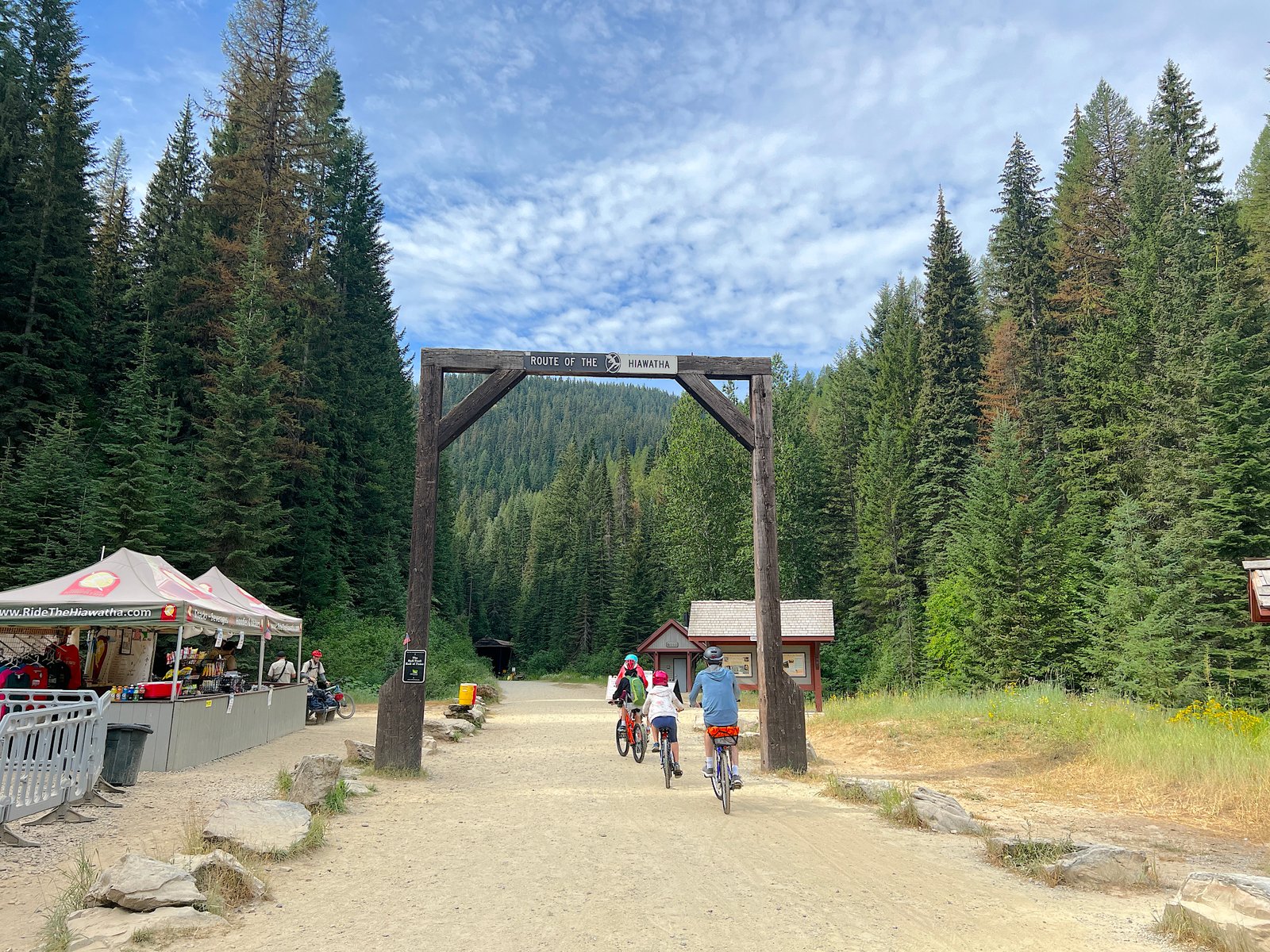
Your adventure on the Route of the Hiawatha begins at Lookout Pass Ski & Recreation Area, located directly at Exit 0 on Interstate 90 on the Idaho–Montana border. This is your primary hub where you’ll pick up trail passes, shuttle tickets, rental bikes, lighting gear, maps, and trail snacks before driving to the starting point.
The trail is conveniently located within driveable distance of several major regional hubs:
- Coeur d’Alene, ID: ~60 miles (1 hour)
- Spokane, WA: ~90 miles (1.5 hours)
- Missoula, MT: ~105 miles (1.5 hours)
- Kalispell, MT: ~145 miles (2.5 hours)
Important Navigation Tip: Cell service becomes unreliable to nonexistent past Exit 0. Download your offline GPS maps or write down these directions before leaving the lodge!
Driving Directions from Lookout Pass to the East Portal Trailhead
After gathering your passes and rental equipment at Lookout Pass, the East Portal Trailhead, Hiawatha Trail System is roughly a 10- to 15-minute drive down the freeway. This trailhead is where you’ll prep your bikes and enter the 1.6-mile Taft Tunnel.
- Get on I-90 East: Drive east on I-90 from Lookout Pass toward Missoula for about 5 miles.
- Take Exit 5 (Taft): Take Exit 5 and turn right at the stop sign.
- Follow the Access Road: Turn left through the large gravel/vacant lot and continue for about half a mile.
- Turn onto Route 506: At the end of the lot, turn right over the wooden bridge onto Forest Service Road 506.
- Ascend to the Trailhead: Follow this unpaved road for roughly 2 miles, keeping left at the fork, and follow the road uphill until you reach the East Portal parking lot.
Trailhead Amenities at East Portal
- Restrooms: Pit toilets available before entering the tunnel.
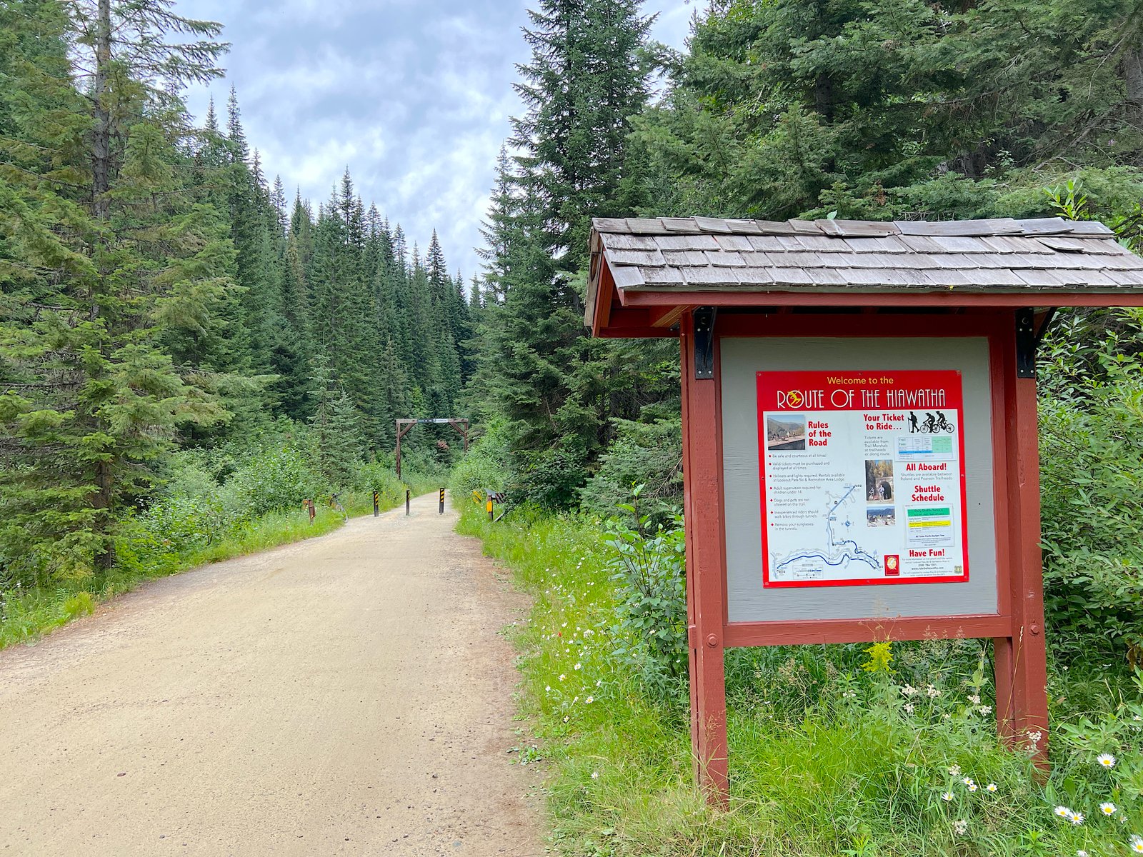
- Information Kiosk: Trail rules, map boards, and staff members checking for valid trail passes.
- Prep Area: Space to unload bikes, turn on headlights, and adjust cold-weather layers before heading into the dark St. Paul Pass Tunnel.
What to Expect on the Trail: The 15-Mile Downhill Journey
The Route of the Hiawatha delivers an unforgettable mix of historic railroad engineering, lush Bitterroot Mountain wilderness, and thrilling dark tunnels. Because the trail maintains a continuous 1.7% downhill grade, you barely need to pedal once you get moving—allowing you to coast, relax, and soak in the scenery.
Phase 1: The St. Paul Pass (Taft) Tunnel
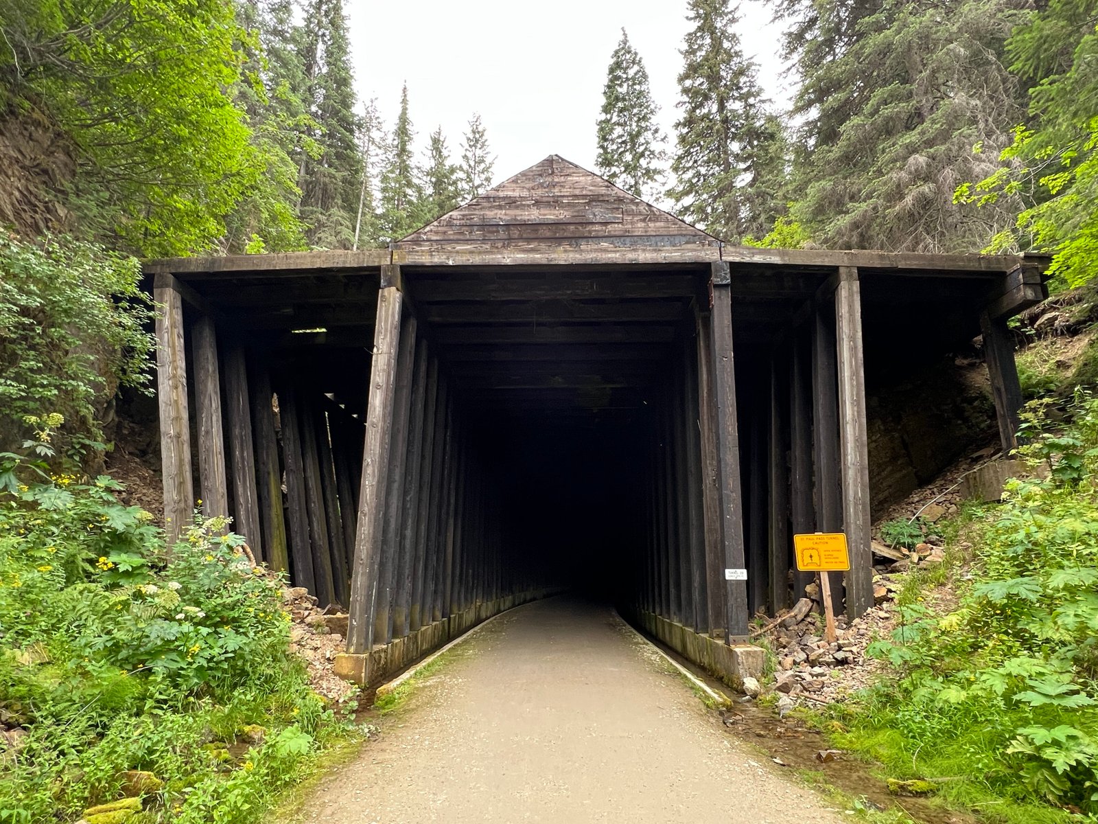
Your ride starts with its most famous and dramatic feature: the 1.66-mile St. Paul Pass Tunnel (also known as the Taft Tunnel).
- Pitch Darkness: Once you ride roughly 100 feet inside, daylight vanishes completely. High-output bike lights or headlamps are mandatory to see the packed gravel path ahead.
- Chilly & Wet Conditions: The tunnel interior hovers around 47°F (8°C) year-round, with water continuously dripping from the arched ceiling (“tunnel rain”). Expect a chilly, damp start and a few muddy patches along the track.
- Sound Effects: Echoes of chatter and bicycle tires crunching on gravel create a surreal atmosphere during the ~10 to 15 minutes it takes to pedal through.
Phase 2: High Trestles & Mountain Canyons
Emerging into the bright sunshine at the Roland side of the tunnel, the landscape opens into the grand Bitterroot Mountains.
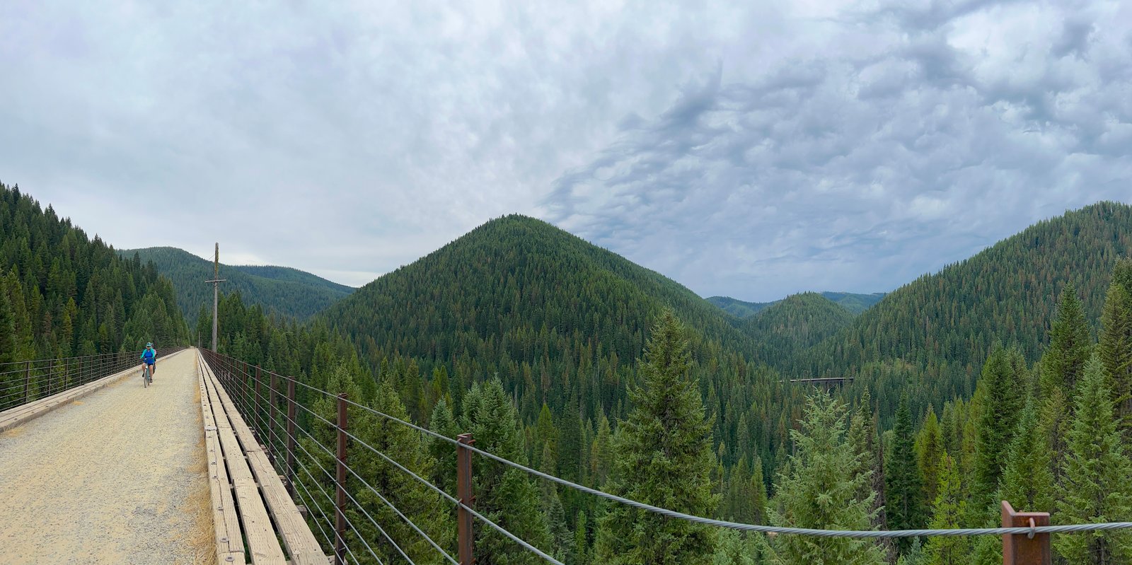
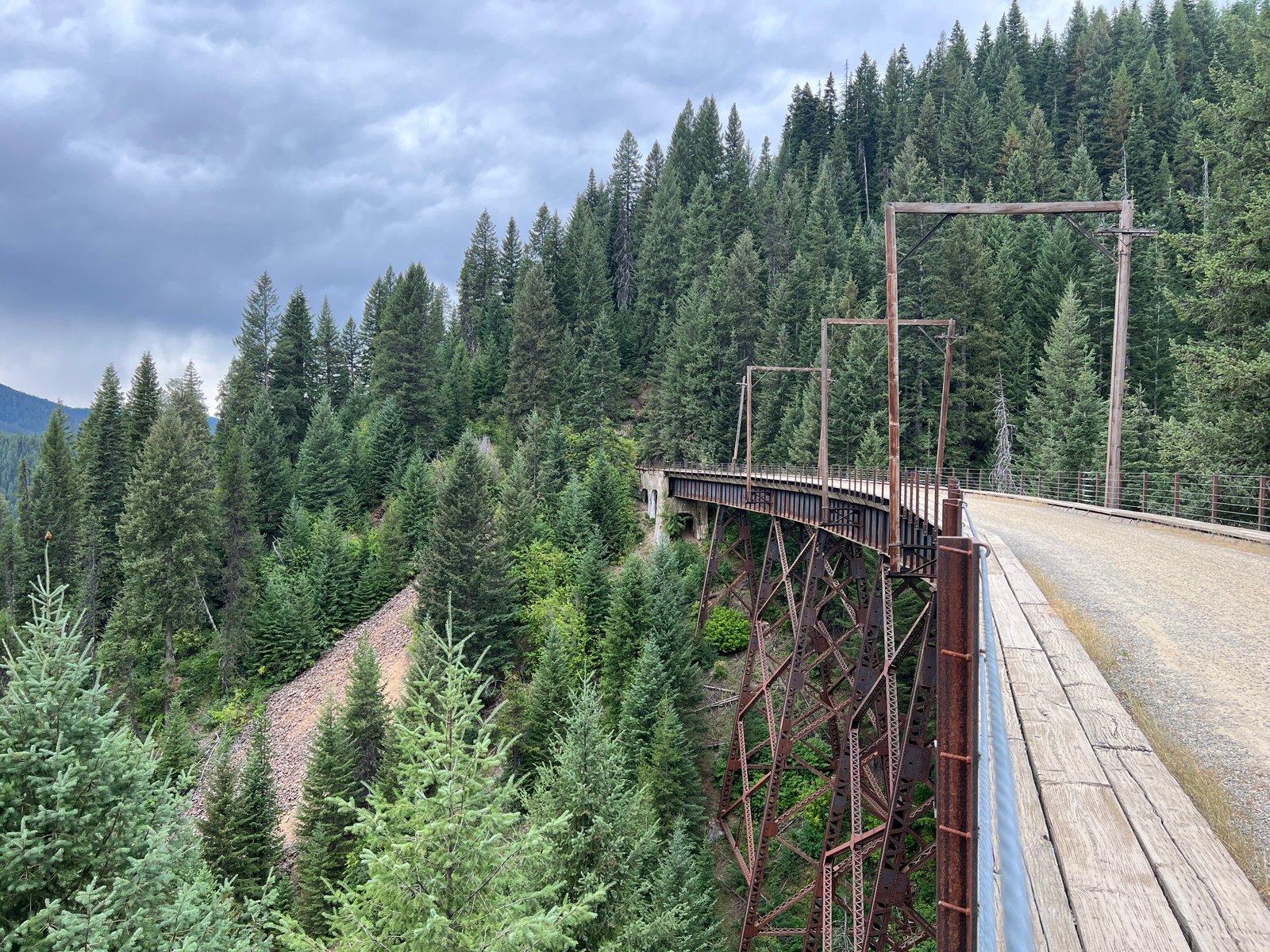
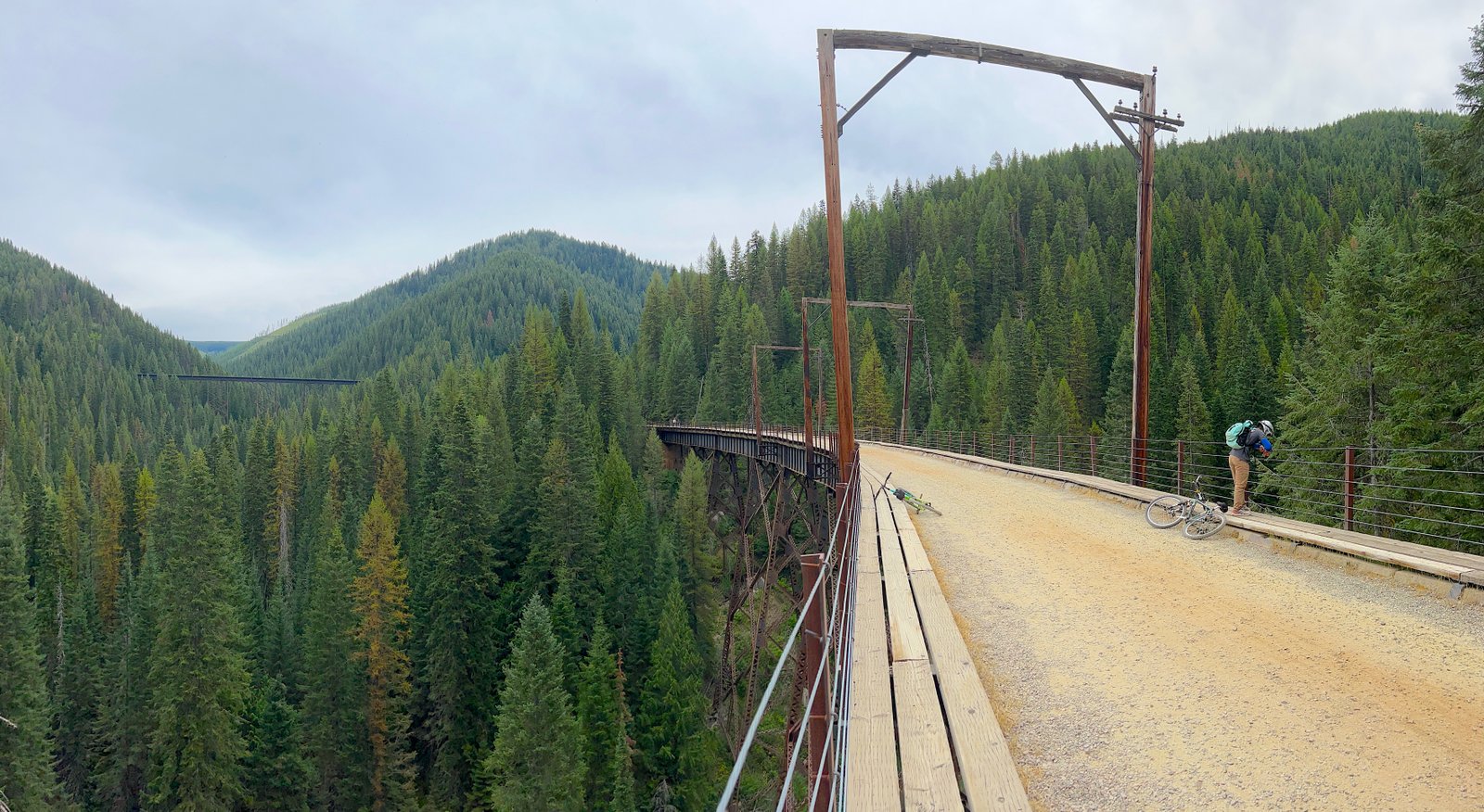
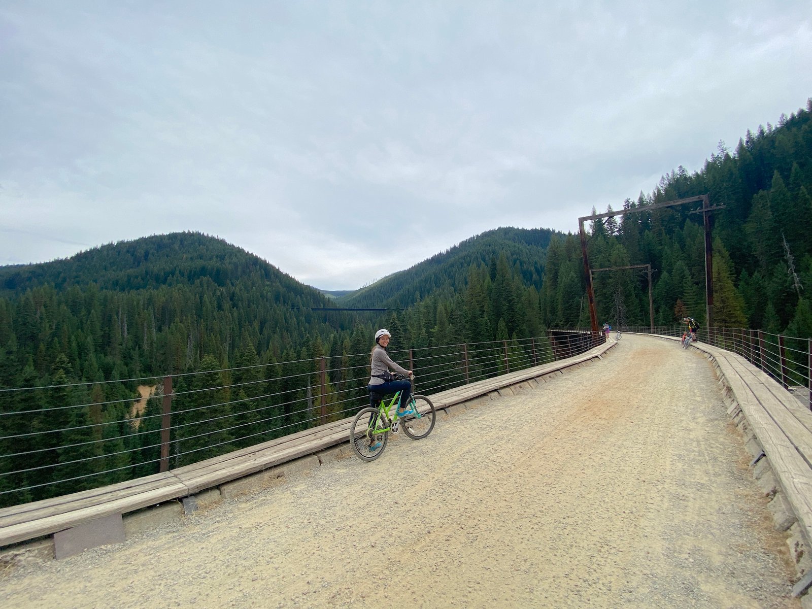
- 7 Sky-High Trestle Bridges: You’ll cross soaring wooden and steel trestles—some standing over 230 feet tall—spanning steep forest canyons with panoramic views of Northern Idaho and Western Montana.
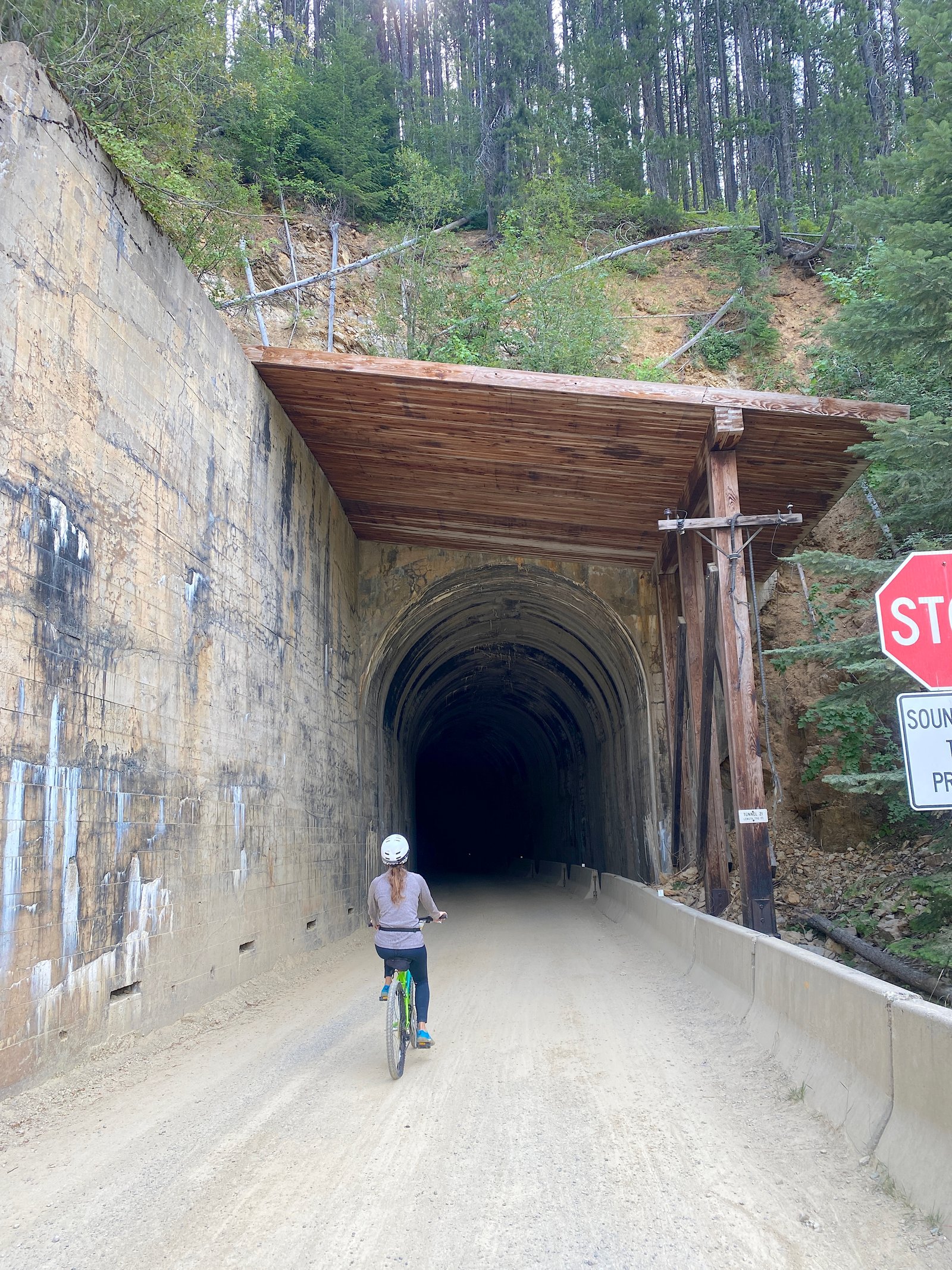
- 9 Additional Tunnels: After Taft, you’ll glide through 9 shorter railroad tunnels carved straight through solid granite cliffs.
- Trail Surface & Flow: The path consists of wide, well-maintained packed dirt and fine gravel. While smooth overall, keep an eye out for occasional loose rocks, small wooden bridge planks, or damp spots near drainage ditches.
Phase 3: Arriving at Pearson & Returning Up
As you coast down toward the lower elevation, the forest thickens and the air warms up significantly compared to the chilly start at East Portal.
- Reaching Pearson Trailhead: At Mile 15, the trail ends at the Pearson staging area. Here you’ll find vaulted restrooms, picnic tables, water stations, and staff coordinating the shuttle loading area.
- Catching the Shuttle: Riders queue up at Pearson to load their bikes onto custom trailers for the drive back up to Roland.
- Option to Pedal Uphill: If you’re on an e-bike or looking for an extra workout, you can turn around and pedal back up the gentle 1.7% incline, experiencing the trestles and tunnels from a completely different perspective.
Best Time to Ride the Route of the Hiawatha (2026 Season)
The 2026 season runs daily from May 22 through September 20, 2026. The trail and facilities open at 8:30 AM.
Watch the Time Zone!
Although the trailhead crosses into Montana, all official operations, ticket windows, and shuttle times run on Pacific Time (PT). If you’re staying in Western Montana (which is on Mountain Time), remember that you will gain an hour driving west across the state line to Lookout Pass.
Time of Day: Why Morning Is Best
Summer temperatures in the Bitterroot Mountains can easily climb into the upper 80s or 90s by early afternoon. Because significant portions of the trail are exposed to direct sunlight, starting early is the secret to a great ride.
- 8:30 AM – 10:00 AM (Ideal Window): Morning rides offer crisp air, quiet trail conditions, smaller shuttle lines at Pearson, and gorgeous morning light reflecting off the trestles.
- Midday Heat: If starting after 11:00 AM, bring extra water and sunscreen. While the Taft Tunnel remains a cool 47°F year-round, the lower sections near Pearson get quite warm.
Seasonal Breakdown: When to Visit
- Late May to June (Spring & Early Summer): Temperatures are cooler, waterfalls alongside the trail are at peak flow, and crowd levels are lower. Tunnels can be extra wet from snowmelt, so rain jackets are essential.
- July to August (Peak Summer): Expect warm sunny days and peak crowds. To beat the heat and avoid afternoon shuttle waits at Pearson, aim to be on the trail as close to 8:30 AM as possible.
- Late August to September (Late Season): Temperatures cool down, mountain foliage begins to turn, and weekday crowds thin out significantly.
Personal Tip from Our Trip:
We rode the Route of the Hiawatha in late August and lucked out with an overcast day. The cloud cover kept the temperatures comfortable for the entire 15 miles and made the mountain views look incredible. If you happen to be visiting during a summer heatwave, book the earliest available window and hit the trail first thing in the morning!
Practical Tips for Riding the Route of the Hiawatha
Whether you’re an experienced cyclist or a casual family rider, these practical insider tips will help keep your ride safe, smooth, and enjoyable from start to finish.
Tunnel & Safety Tips
- Bring a High-Lumen Bike Light: The 1.66-mile St. Paul Pass Tunnel is pitch black. Use a handlebar-mounted light with at least 300 to 400+ lumens (plus a small headlamp or backup flashlight in your backpack just in case).
- Layer Up for the Chilly Start: The Taft Tunnel hovers around 47°F (8°C) year-round with cold water dripping from above (“tunnel rain”). Wear a light water-resistant jacket or windbreaker for the first two miles, then stow it in your bag once you emerge into the sunshine.
- Control Your Speed on Wet Gravel: Tunnel interiors and bridge approaches can have wet mud or loose gravel patches. Keep both hands on your handlebars, maintain a steady speed, and avoid sudden sharp braking inside the dark tunnels.
Trail Comfort & Pacing
- Prep for Direct Sun Exposure: Once you leave the main tunnel, large stretches of the rail-trail are unshaded. Pack plenty of water, wear sunscreen, and consider a brimmed hat or sunglasses for breaks.
- Make Use of Scenic Pullouts: Don’t rush! Scenic lookouts, historical interpretive signs, and high trestle bridges offer incredible photo opportunities along the Bitterroot Mountains. Build in extra time to stop and enjoy the views.
- Pace for Families & Beginners: The 1.7% downhill slope makes pedaling light, but total trail time ranges from 2 to 4 hours. Allow extra time for younger kids or non-bikers to take water breaks and shake out their legs.
Logistics & Timing
- Watch the Shuttle Deadlines: Keep track of the final shuttle pickup time at Pearson (4:15 PM on weekdays; 5:45 PM on weekends). Missing the last bus means a long 15-mile pedal back uphill!
- E-Bike Advantage: If you are riding an e-bike, consider skipping the return shuttle fee altogether. The gentle pedal-assist incline makes riding back up to Roland a quiet, scenic breeze.
- Ride Early to Beat Crowds: Hitting the trail between 8:30 AM and 9:30 AM guarantees cooler temperatures, emptier tunnels, shorter photo waits on trestles, and zero lines at the Pearson shuttle pickup.
What to Bring: Route of the Hiawatha Packing List
Because the Route of the Hiawatha is in a remote mountain setting with zero on-trail convenience stores, coming prepared is essential. Between the pitch-black 47°F tunnel start and the sunny, 15-mile downhill descent, here is everything you need for a comfortable and stress-free ride.
Essential Riding Gear
- Bicycle: Bringing your own bike saves around $40 per person. If you need to rent, Lookout Pass offers standard mountain bikes, comfort cruisers, kid-sized bikes, adult tricycles, recumbents, tandem bikes, Burley child trailers, and tag-a-longs.
- Note on E-Bikes: Lookout Pass does not rent e-bikes. However, you can rent e-bikes nearby at Spokehouse E-Bike Rentals in Wallace, Idaho (roughly 20 minutes west of Lookout Pass).
- Helmet (Mandatory): Helmets are strictly required for all riders on the trail. Helmets are included with all Lookout Pass bike rentals, or you can rent one individually for $12.
- High-Lumen Bike Light or Headlamp: Crucial for navigating the 10 dark tunnels. Make sure your lights are fully charged or have fresh batteries—our light actually died mid-ride, and smartphone flashlights were definitely not bright enough for the 1.6-mile Taft Tunnel! Pro Tip: Turn your headlight off as soon as you exit each tunnel to conserve battery life for the rest of the trip.
- Sturdy Closed-Toe Shoes: With gravel terrain, wet tunnel puddles, and occasional stops along trestle footpaths, sturdy sneakers or hiking shoes are a must for grip and pedal control.
Clothing & Weather Layers
- Light Jacket or Layer: The 1.66-mile Taft Tunnel stays around 47°F (8°C) year-round, with cold water continuously dripping from the ceiling.
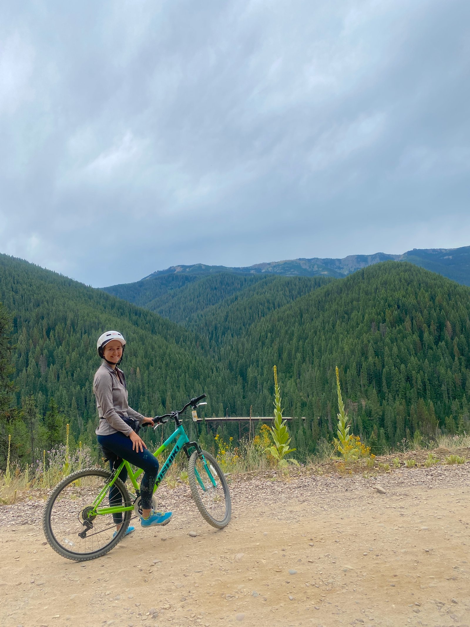
- What We Wore: We wore long sleeves and long pants to keep chilly tunnel drips and fine wet gravel mud from sticking to our skin. If you tend to run cold, a cozy zip-up fleece like the Columbia Women’s Benton Springs Full Zip Jacket is an easy layer to throw on inside the tunnels and stow in your backpack once out in the sun.
Hydration, Food & Trail Etiquette
- Plenty of Water: Afternoon temperatures in the Bitterroot Mountains can top 90°F–100°F, and there are no potable water stations along the 15-mile route once you leave the trailhead. Bring more water than you think you need.
- Gear Recommendation: We love using Simple Modern Insulated Bottles—they come in multiple sizes, fit into standard bike cages or backpacks, and keep water ice-cold even on hot summer afternoons.
- Lunch & Snacks: With frequent photo stops, the 15-mile ride typically takes 2 to 4 hours. Pack trail mix, granola bars, or a full picnic lunch to enjoy at one of the scenic trestle pullouts.
- Small Trash Bag (Leave No Trace): There are no trash cans along the trail. Bring a small plastic bag in your pack to haul out all food wrappers, fruit peels, and waste back to the trailhead bins.
Sun Protection & Photography
- Sun Protection (Sunscreen, Hat & Sunglasses): Most of the trail outside the tunnels is exposed to direct sunlight.
- Family Favorite: Earth Mama’s Mineral Sunscreen (SPF 40) is our go-to family-friendly option. It’s water-resistant, made with clean non-nano zinc ingredients, and comes in both a smooth lotion and an easy on-the-go face stick that kids love.
- Camera or Smartphone: Between the towering wooden trestles, historical interpretive markers, and sweeping canyon views, you’ll want to take plenty of photos. As a Rails-to-Trails Hall of Fame inductee and USA Today Top 10 Pick, this is an experience you’ll definitely want to document!
Amenities on the Trail & Trailhead Facilities
Because the Route of the Hiawatha runs through a remote section of the Bitterroot National Forest, services along the 15-mile path are limited. Knowing where restrooms, parking, and shuttle stops are located will help you plan a smooth trip.
1. East Portal Trailhead (The Main Starting Point)
Located on the eastern side of the St. Paul Pass Tunnel, the East Portal serves as the primary starting point for most riders.
- Parking: Large gravel parking lot ($5 U.S. Forest Service parking pass required or valid Recreation Pass).
- Restrooms: Vault toilets located near the tunnel entrance and parking area.
- Services: Small retail kiosk selling snacks, cold drinks, water, souvenir gear, and replacement bike lights or batteries.
- Rental Delivery: If you arranged for Lookout Pass to deliver your rental bikes directly to the trailhead, this is where you will pick them up and drop them off.
2. Roland Trailhead (West Portal)
Located on the western exit of the 1.66-mile Taft Tunnel, Roland serves as the primary shuttle drop-off point.
- Facilities: Vault toilets and informational signage.
- Shuttle Drop-Off Hub: When you take the return shuttle from the bottom of the trail, the bus drops you off right here at Roland. From here, you will pedal the final 1.66 miles back through the dark Taft Tunnel to return to your car at East Portal.
- Alternative Parking: If you bring your own bikes and want to skip riding through the long Taft Tunnel entirely, you can park at Roland and begin your ride directly from the West Portal.
3. Restrooms Along the Trail
- 7-Mile Restroom: After leaving the East Portal, the only mid-trail restroom is located near Milepost 7 (roughly halfway down the trail).
- Planning Tip: Make sure everyone in your group uses the facilities at East Portal or Roland before starting the descent!
4. Pearson Trailhead (The Bottom of the Trail)
Pearson marks the 15-mile finish line of the Route of the Hiawatha and serves as the staging area for the return trip.
- Facilities: Vault toilets, shaded picnic tables, water refill access, and a covered shelter area.
- Shuttle Loading Area: This is where you queue up to load your bike onto trailers and board the shuttle bus back up to Roland.
- Shuttle Wait & Ride Times:
- Wait Times: On busy summer weekends, shuttle wait times at Pearson can range from 45 minutes to over 2 hours between 12:30 PM and 3:00 PM. Starting your ride early in the morning helps you avoid these peak queues.
- Drive Duration: The shuttle bus ride from Pearson up the mountain dirt roads to Roland takes approximately 30 to 40 minutes.
Nearby Towns: Where to Stay, Eat & Rent Gear
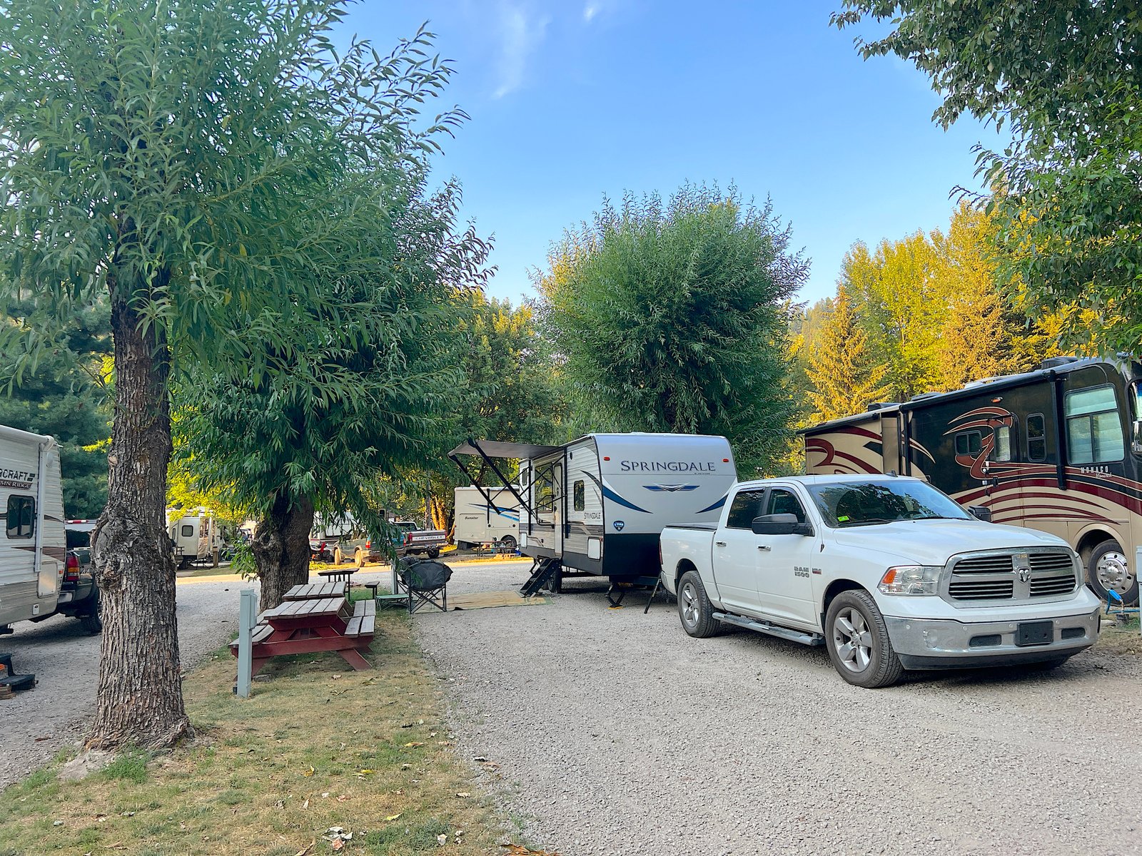
Because there is no lodging directly at the trailhead, most riders base themselves in one of the historic Silver Valley towns along the Interstate 90 corridor in Northern Idaho. Each town offers a distinct vibe, from historic mining charm to full-service mountain resorts.
1. Wallace, Idaho (The Best Overall Basecamp)
- Drive to Lookout Pass: ~12 miles (~15 to 20 minutes west)
- Vibe: Historic mining town known as the “Silver Capital of the World”.
- Why Stay Here: The entire downtown district of Wallace is listed on the National Register of Historic Places, featuring brick storefronts, local breweries, antique shops, and old-west architecture. It is the most popular basecamp for Hiawatha riders.
- E-Bike Rental Hub: Wallace is home to Spokehouse E-Bike Rentals, making it the closest spot to rent pedal-assist bikes to haul to the trail.
- Local Highlights: Historic Wallace Mining Museum, The Prime Steakhouse, Wallace Brewing Company, and direct access to the paved Trail of the Coeur d’Alenes bike path.
2. Mullan, Idaho (Closest to the Trailhead)
- Drive to Lookout Pass: ~6 miles (~7 to 10 minutes west)
- Vibe: Quiet, historic mountain town nestled right at the base of the pass.
- Why Stay Here: Mullan is the closest town to Lookout Pass Exit 0. While lodging options are limited to small vacation rentals, it is an extremely convenient pit stop to grab last-minute gas, water, or snacks right before hopping on Interstate 90 to head up the mountain.
3. Kellogg, Idaho (Best for Families & Mountain Resorts)
- Drive to Lookout Pass: ~24 miles (~25 to 30 minutes west)
- Vibe: Mountain resort hub with full amenities.
- Why Stay Here: Kellogg offers larger hotel chains, grocery stores, and expanded dining options. It is home to Silver Mountain Resort, which features an indoor waterpark, scenic gondola rides, and downhill mountain bike trails—making it a great multi-day basecamp if you are combining the Hiawatha with other outdoor adventures.
4. Missoula, Montana or Coeur d’Alene, Idaho (Day-Trip Options)
If you prefer staying in a larger city, both Coeur d’Alene, ID (1 hour west) and Missoula, MT (1.5 hours east) offer major resort hotels, boutique lodging, and vibrant downtown food scenes within an easy morning drive of Lookout Pass.
Our Experience on the Route of the Hiawatha: Trail Play-by-Play
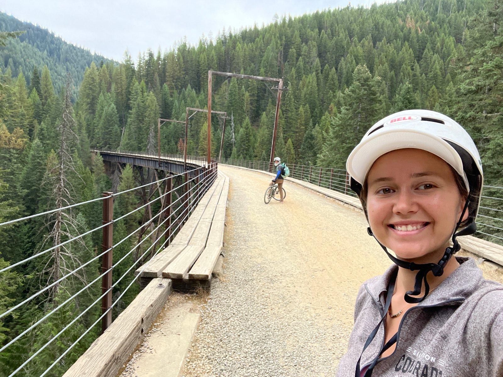
Riding the Route of the Hiawatha is an incredible mix of adrenaline, history, and raw mountain scenery. Here is what it actually feels like to experience the 15-mile journey from start to finish.
Mile 0 to 1.7: The Eerie Darkness of the Taft Tunnel
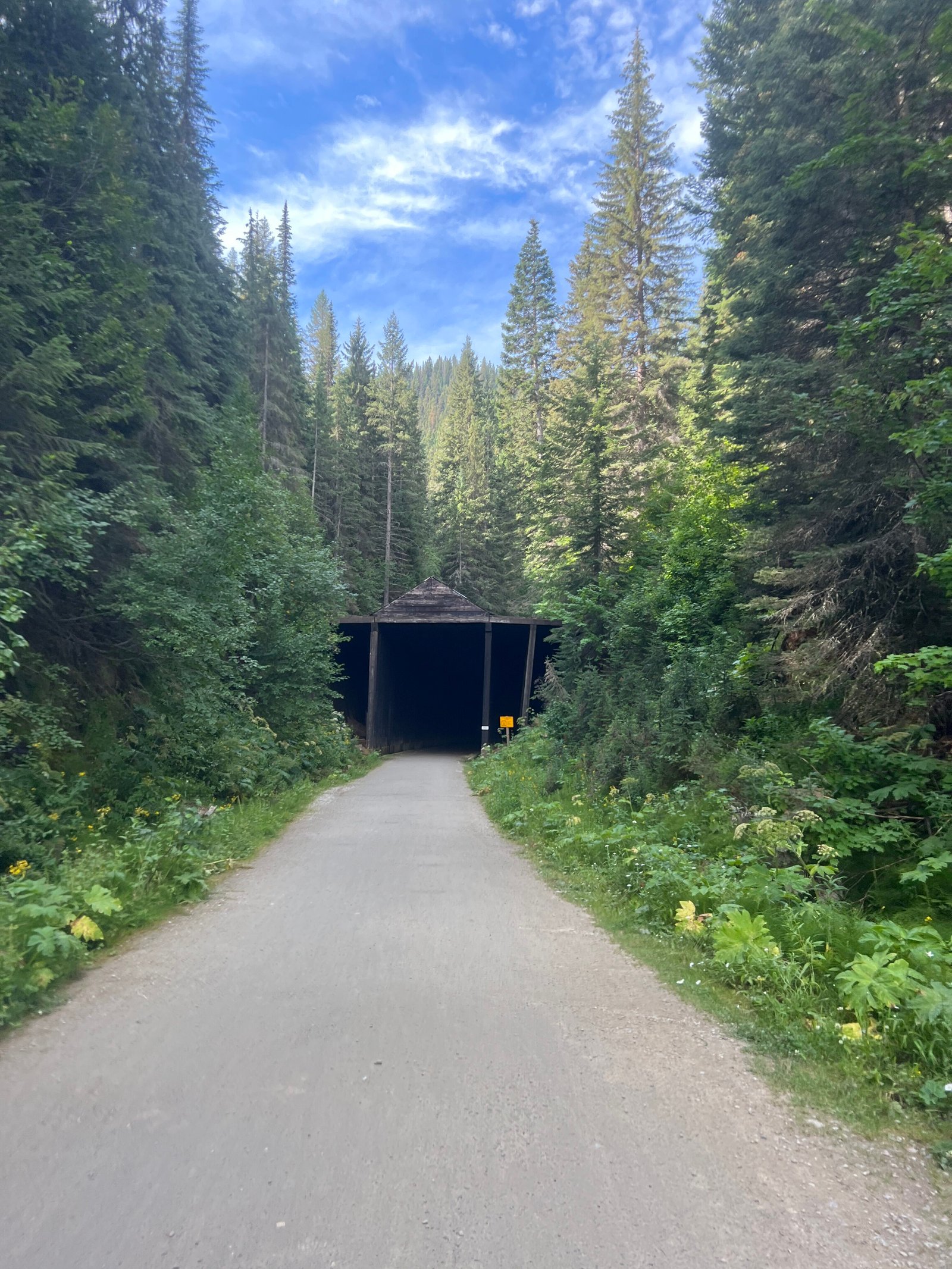
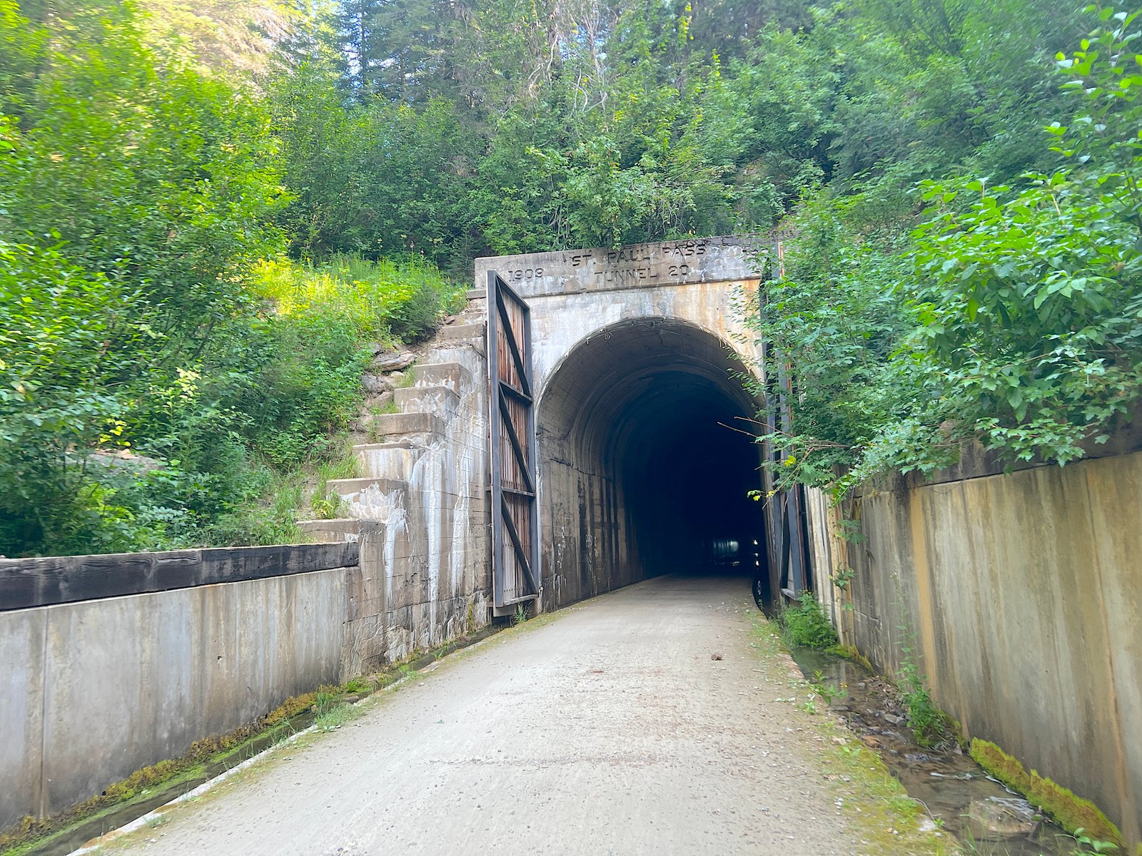
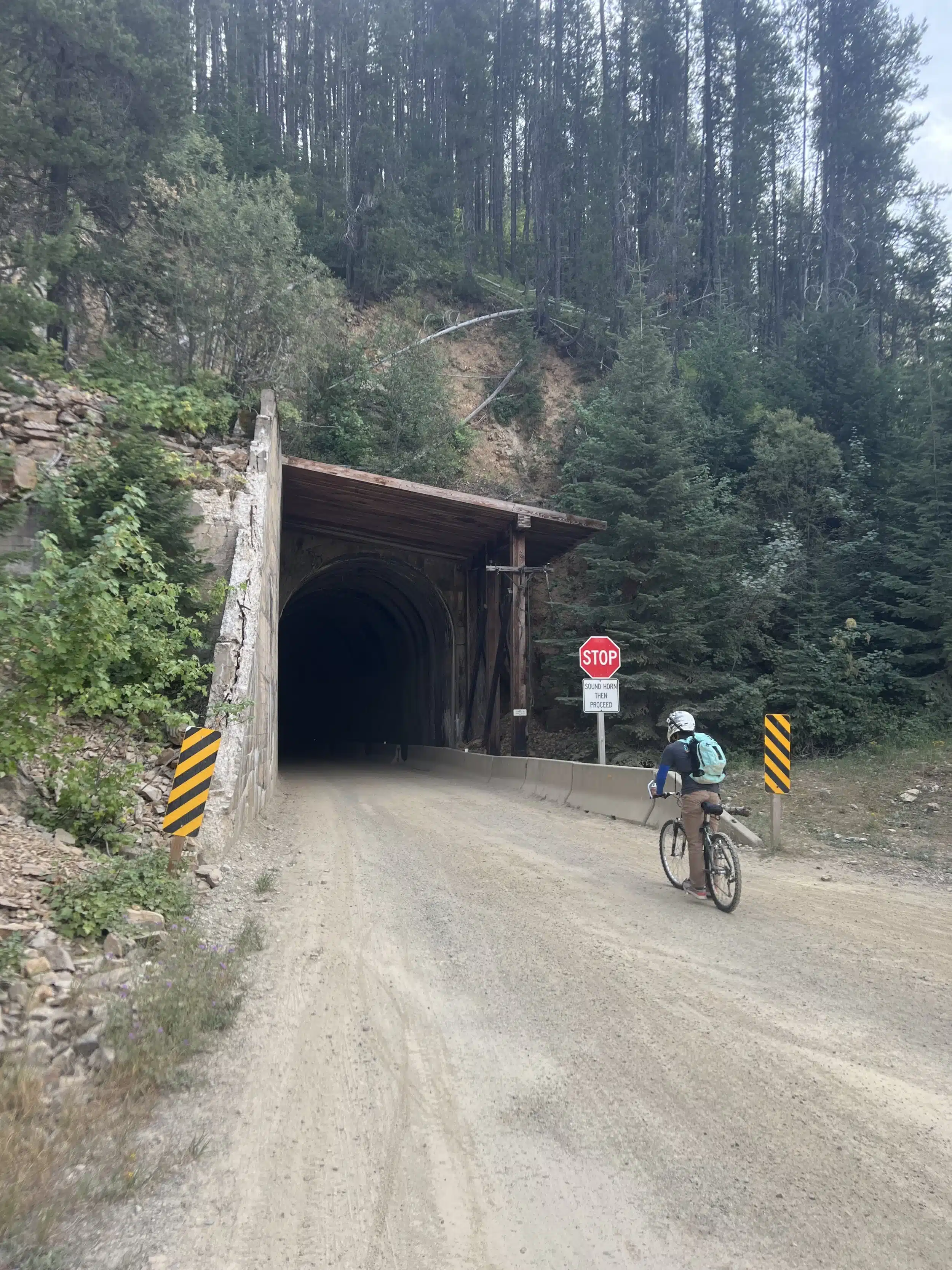
Our adventure began at the East Portal Trailhead in Montana, right at the entrance of the legendary 1.66-mile St. Paul Pass (Taft) Tunnel. Entering the tunnel is an immediate shock to the senses—it’s cold, damp, and pitch black.
The entrance looks spooky, and with water dripping from the ceiling into the absolute dark, it genuinely felt like we were biking straight into the set of a horror movie! Because of the slight arch inside, you can’t see the exit’s “light at the end of the tunnel” for a long time. It took us nearly 20 minutes to pedal through, making it one of the most surreal and thrilling parts of the entire ride.
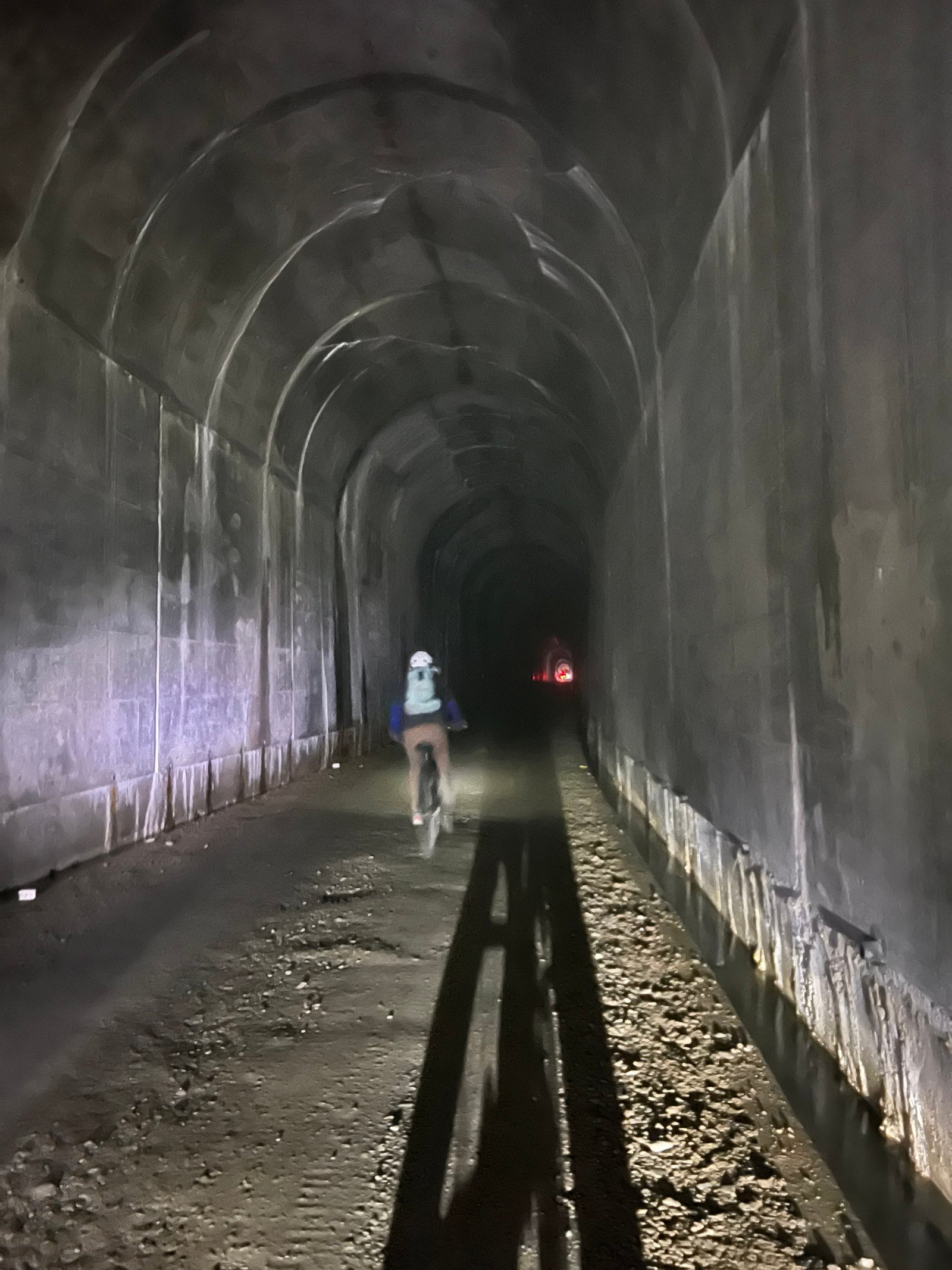
Safety Tip: The tunnel floor has drainage gutters running along both sides. Keep your bike steady in the center of the path until you emerge into the daylight.
Mile 1.7 to 5.3: Waterfalls, Open Vistas & First Tunnels
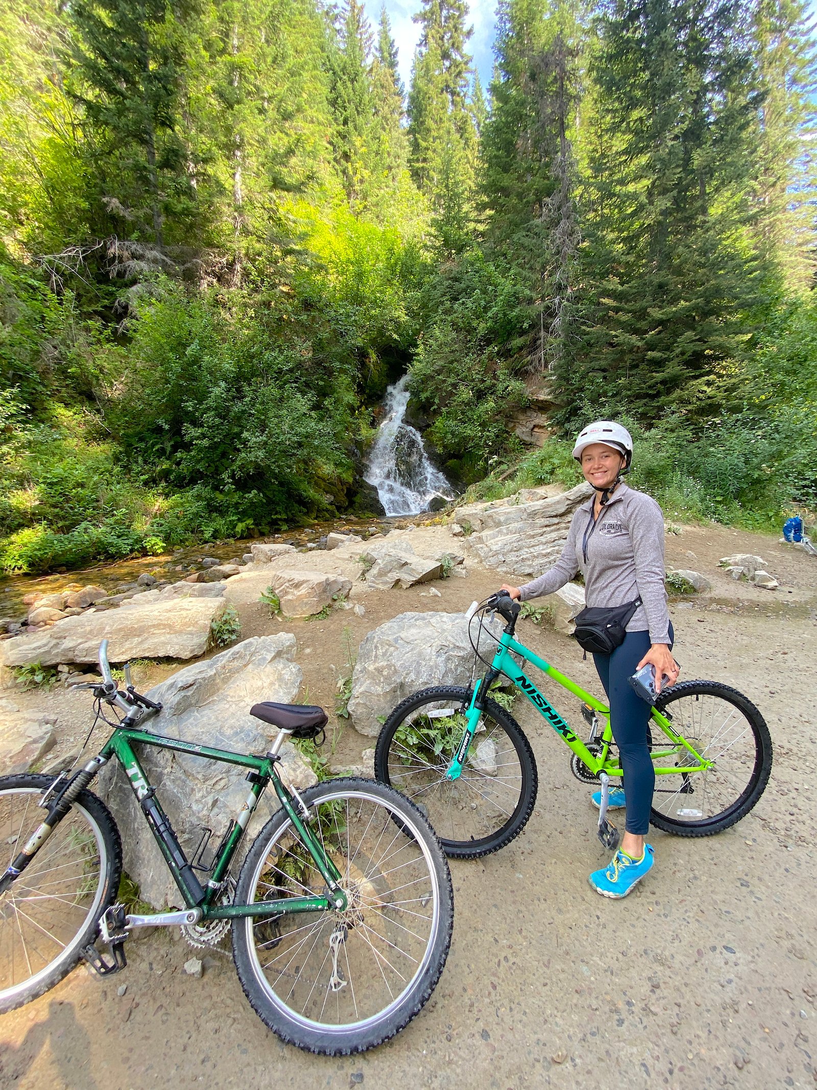
Emerging from the darkness at the West Portal (Roland), we were instantly greeted by a gorgeous cascading waterfall off to the right.
For the next 1.4 miles, the path opens up to sweeping views across the Bitterroot Mountains. Keep in mind that this specific upper stretch is occasionally shared with shuttle vehicles driving up from Pearson, so stay alert and ride single file.
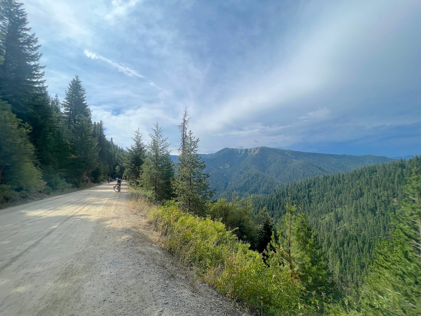
Continuing another 1.8 miles, you’ll pass through three more historic tunnels. You’ll also spot a fourth tunnel that has been permanently blocked off—don’t worry, a clear bypass path leads you safely around it.
Mile 5.3 to 9.9: High Trestles & Mountain Views
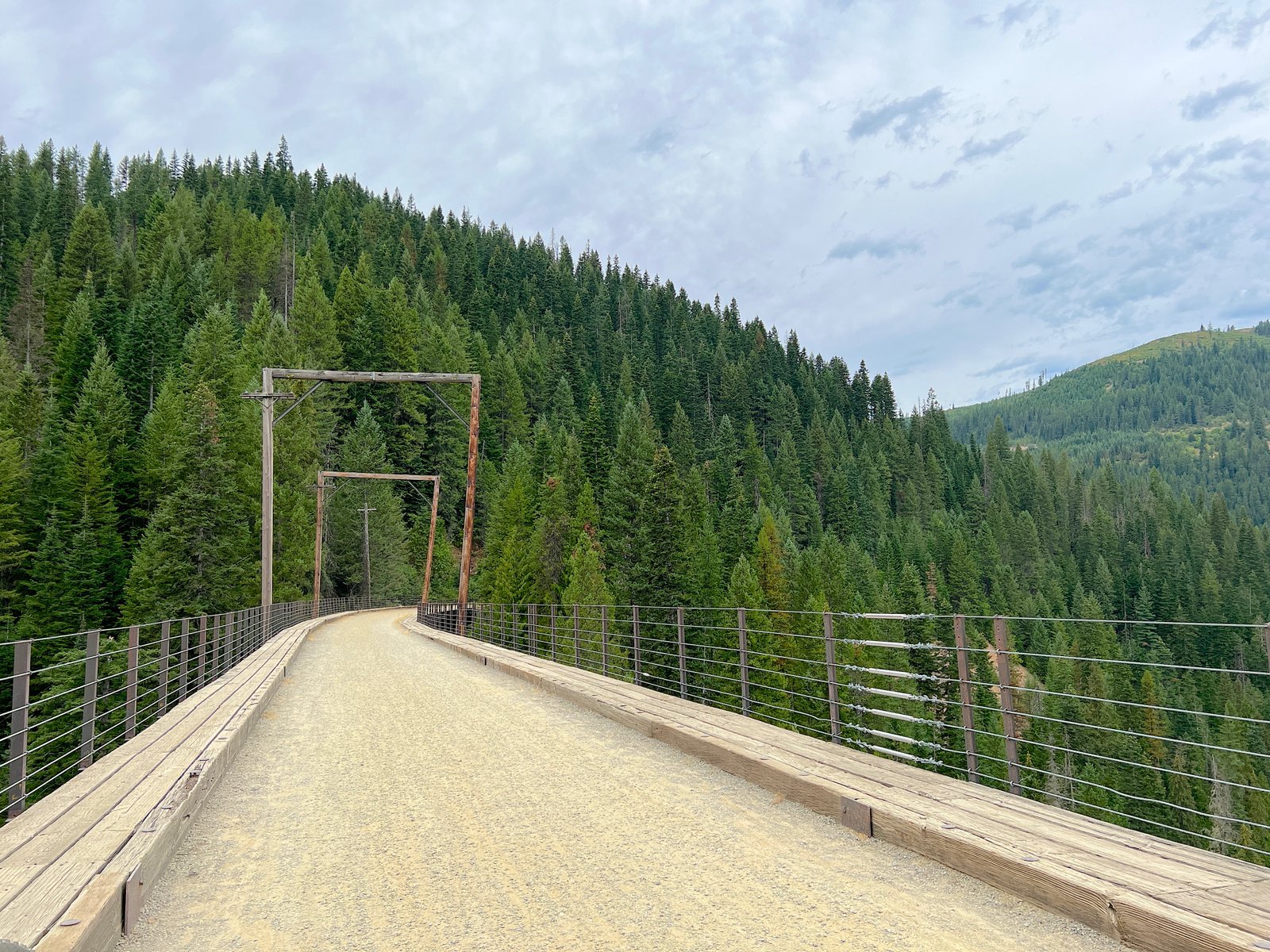
Around Mile 5.3, we reached our first sky-high trestle bridge. It is an absolute must-stop spot to pull over, grab your camera, and look out across the canyon. In the distance, you can see the wooden frameworks of other trestles tucked into the evergreen mountainside.
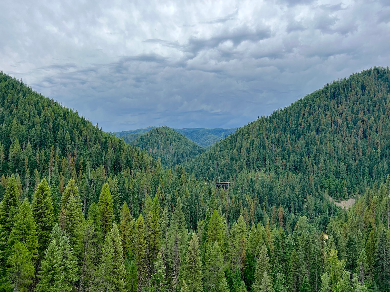
Over the next 4.6 miles, you’ll cross six more soaring trestles and glide through four additional tunnels.
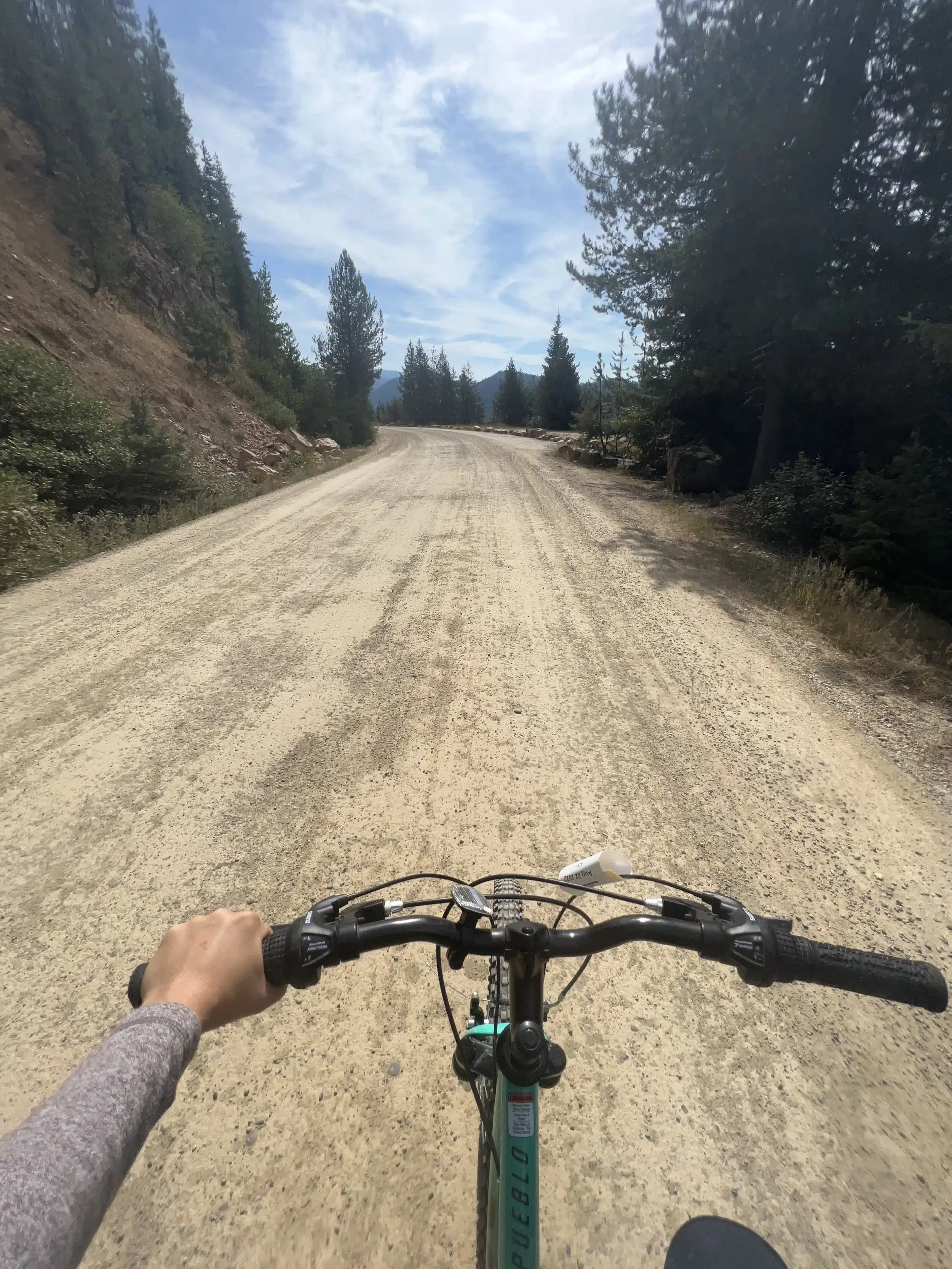
Why We Pedaled Uphill (And Why We’d Rent E-Bikes Next Time!)
At around Mile 9.9, we decided to do something a bit crazy: we turned around and pedaled the 9 miles back up to the trailhead instead of taking the return shuttle!
Continuous pedaling in first gear up a steady 1.7% incline for several miles was definitely a workout. We had to stop a few times to catch our breath, but the quiet surroundings and extra time on the trestles made it worth the effort for us. That said—if we do the uphill return again, we will 100% rent e-bikes!
Mile 9.9 to 15.0: The Final Descent to Pearson
The final 4.4 miles of the trail wind down through thick pine forests, passing through one last tunnel before ending at the Pearson Trailhead.
If you chose the shuttle pass, Pearson is where you’ll catch the bus back to Roland (West Portal), where you’ll pedal the final 1.66 miles through the Taft Tunnel to reach your car at East Portal.
FAQ: Route of the Hiawatha Scenic Bike Trail
How long does it take to ride the Route of the Hiawatha?
Most riders complete the 15‑mile downhill ride in 2–3 hours, depending on how often they stop for photos, water breaks, and historical interpretive signs. If you choose to pedal back uphill instead of taking the return shuttle, allow an additional 2 to 3 hours for the climb.
Is the trail suitable for kids and non-bikers?
Yes! The 1.7% downhill slope makes the ride exceptionally beginner- and family-friendly. However, keep in mind that the initial Taft Tunnel is pitch black, 47°F, and nearly 1.7 miles long—younger children may need extra reassurance and high-output bike lights to feel comfortable.
Are e-bikes allowed on the Route of the Hiawatha?
Yes, Class 1 e-bikes (pedal assist only) are permitted on the trail. While Lookout Pass Lodge does not rent e-bikes directly, you can rent them nearby at Spokehouse E-Bike Rentals in Wallace, Idaho. Note that taking an e-bike on the return shuttle incurs a $10 specialty bike surcharge.
Do you have to ride through the Taft Tunnel?
If you park at the main East Portal Trailhead, yes—the Taft Tunnel is the starting gateway for the entire trail. However, if someone in your party suffers from severe claustrophobia or prefers to skip the tunnel entirely, you can park at the Roland Trailhead (West Portal) and begin your ride from there.
Is the Taft Tunnel scary?
Because the tunnel is pitch black, cold (47°F), and damp with ceiling drips, the initial entrance can feel spooky! However, once your eyes adjust and your headlight illuminates the packed gravel path, most riders find it exciting and surreal rather than scary.
Are there bathrooms on the trail?
Yes, vault toilets are available at three main locations:
- East Portal Trailhead (Mile 0)
- Roland Trailhead (West Portal, Mile 1.7)
- Pearson Trailhead (Mile 15)
Note: The only mid-trail restroom after leaving Roland is located around Milepost 7, so plan bathroom stops accordingly!
Do you need advance reservations for passes and rentals?
Strongly recommended. Weekend trail passes, shuttle slots, and bike rentals frequently sell out weeks in advance during peak summer months (July and August). Booking online ahead of time also saves a few dollars per pass compared to window rates.
Can you walk the Route of the Hiawatha instead of biking?
Pedestrians are permitted, but walking the full 15 miles on gravel in summer heat takes roughly 5 to 6+ hours and is quite strenuous. The vast majority of visitors complete the trail on bicycles.
Is taking the shuttle required?
No! You are free to turn around at Pearson and pedal the 15 miles back up the mountain. While the continuous 1.7% incline is a workout on standard bicycles, pedal-assist e-bikes make the uphill return a breeze.
What is the best time of day to ride?
Aim to start between 8:30 AM and 10:00 AM. Early morning rides offer crisp mountain air, less sun exposure, shorter wait times for photography on trestle bridges, and zero waiting lines at the Pearson return shuttle.
What should I wear inside the dark tunnels?
Dress in layers! Wear a lightweight water-resistant windbreaker or jacket to stay warm inside the 47°F Taft Tunnel. Long sleeves and closed-toe shoes also protect skin from chilly “tunnel rain” drops and damp road splashback.
Final Thoughts: Is the Route of the Hiawatha Worth It?
The Route of the Hiawatha is one of those rare trails that feels both deeply historic and wildly adventurous. Offering a breathtaking mix of pitch-black tunnels, soaring trestle bridges, sweeping mountain vistas, and quiet forest stretches, it delivers an outdoor experience you simply won’t find anywhere else in the Pacific Northwest.
Whether you ride it as a once-in-a-lifetime family road trip or turn it into an annual summer tradition, it’s the kind of day out that stays with you long after you’re off the bike. With just a little bit of planning, the right lighting gear, and plenty of time carved out to take photos, this historic rail-trail is easily one of the most memorable summer adventures along the Idaho–Montana border.
Helpful Links & Resources
Before hitting the trail, use these official resources to check current trail conditions, book your tickets, and reserve rental equipment:
- Route of the Hiawatha Official Website – Official portal managed by Lookout Pass for trail passes, shuttle tickets, rental bookings, and operational updates.
- Lookout Pass Ski & Recreation Area – Information on lodge amenities, season updates, and directions to Exit 0 on I-90.
- U.S. Forest Service – Idaho Panhandle National Forests – Official recreation guidelines, parking pass rules, and forest alerts for the Bitterroot Mountains region.
- Spokehouse E-Bike Rentals – Nearby e-bike rental options located in historic Wallace, Idaho.
More Idaho Adventures
Planning a trip through Idaho? Check out these other Idaho adventures and travel guides to help you discover more of the state’s scenic trails, outdoor activities, and hidden gems.