Hike to 3 picturesque blue alpine lakes on Colorado’s stunning Blue Lakes Trail. Featuring everything you need to know before you go, including, best time to hike, what to bring, all about the trail, and much more.
If you are looking for an unforgettable, magnificent, and thrilling adventure in Colorado this summer, look no further than the challenging 8 mile hike to the Blue Lakes.
This scenic trail showcases a thriving mountain landscape, blooming with wildflowers, and picturesque blue alpine lakes. Of the 150+ miles Mike & I have hiked, this trail is by far our favorite.
The trailhead itself starts at 9,300 feet, so those visiting from lower elevations may have some difficulty on this trail. Remember to bring plenty of water, snacks, sun protectant, and take your time.
This post contains affiliate links, so we may earn a small commission when you make a purchase through links on our site at no additional cost to you.
TRAIL STATS
Distance: 8.7 Miles | Difficulty: Strenuous | Elevation Gain: 2,509 FT | Time: 6 Hrs
GETTING TO THE BLUE LAKES TRAILHEAD
The Blue Lakes Trail is located in southwest Colorado in the Uncompahgre National Forest. It’s surrounded by the Mount Sneffels Wilderness area with countless mountain peaks towering over 13,000 feet.
The trail is located 30 minutes from Ridgway off CO 62 and then down CO Rd 7, a 9 mile gravel road, suitable to most vehicles. However during the winter months the road many require 4WD vehicles.
- Ridgway – 14 miles or 30 minutes
- Ouray – 24 miles or 45 minutes
- Telluride – 44 miles or 1 hour
- Grand Junction – 100 miles or 2 hours
- Colorado Springs – 275 miles or 5.5 hours
- Denver – 336 miles or 6 hours

BEST TIME TO HIKE
The Blue Lakes Trail is open year round with seasonal temperatures varying greatly. Summers are the busiest time for hiking this trail. Parking at the trailhead is minimal and fills up early in the day. Temperatures can reach the 70’s with frequent afternoon thunderstorms.
Winters hang out below freezing with possibility of avalanches. Snowshoes, microspikes and 4WD vehicles are recommended if hiking this trail during the winter months. Always check for current conditions before hiking.
WHAT TO BRING
Plenty of Water
Be sure to pack extra water and stay hydrated while exploring. We love adding LMNT’s electrolyte packets to our insulated water bottles to stay hydrated for the whole day.

Simple Modern Water Bottle with Straw and Chug Lid Vacuum Insulated Stainless Steel Metal Thermos | Reusable Leak Proof BPA-Free Flask for Sports Gym | Summit Collection | 32oz, Sea Glass Sage
Sun Protectant
Weather can be unpredictable on the trail so it’s best to bring your favorite sunscreen and wear sun protectant clothing when hiking.

Libin Women’s Full Zip UPF 50+ Sun Protection Hoodie Jacket Long Sleeve Sun Shirt Hiking Outdoor Performance with Pockets Ice Blue M
First Aid Kit
It’s never a bad idea to carry a small first aid kit while hiking. Cell service doesn’t really exist on the trail so it’s good to be prepared in case of an emergency.

General Medi Mini First Aid Kit, 110 Piece Small First Aid Kit – Includes Emergency Foil Blanket, Scissors for Travel, Home, Office, Vehicle, Camping, Workplace & Outdoor (Red)
Crampons
In case there’s snow on the trails, it’s a good idea to carry a pair of crampons so you don’t slip on ice or snow.

Crampons Ice Cleats Traction Snow Grips for Boots Shoes Women Men Anti Slip 19 Stainless Steel Spikes Safe Protect for Hiking Fishing Walking Climbing Mountaineering
Jacket
Temperatures at higher elevations can be 10 to 15 degrees cooler so its not a bad idea to carry a warm jacket with you.

Columbia Women’s Benton Springs Full Zip, Cirrus Grey Heather, Medium
Hiking Sticks
These have been a LIFE SAVER. Hiking sticks are so helpful in giving you extra support as you climb up steep trails as well as coming down steep trails. They provide extra stability and we no longer hike without them.

Montem Ultra Strong Trekking, Walking, and Hiking Poles – One Pair (2 Poles) – Collapsible, Lightweight, Quick Locking, and Ultra Durable (Black Matte)
Hiking Shoes
To have the most comfortable experience on the trails we recommend wearing a proper hiking shoe or boot to provide good traction and support.

Columbia Women’s Newton Ridge Plus Hiking Shoe, Elk, River Blue, 7
AMENITIES NEARBY
RIDGWAY
A small town located 30 minutes from the Blue Lakes trailhead. Known for its art galleries, historic landmarks, and local shops.
LODGING
- Chipeta Lodge
- MTN Lodge Ridgway
RV PARKS
- Ridgway State Park
FOOD
- The Market at Ridgway
- Family Dollar
- Eatery 66
- Lazy Dog Saloon
- True Grit Cafe
- The Ridgway
- GNAR Tacos
- Thai Paradise
- Land & Ocean

OURAY
A small town located on the north side of the scenic Million Dollar Highway and known as the Switzerland of America.
LODGING
- Twin Peaks Lodge & Hot Springs
- St. Elmo Hotel
- Hotel Ouray
- Ouray Main Street Inn
- Beaumont Hotel & Spa
- Ouray Inn
- Matterhorn Inn & Suites
RV PARKS
- 4J + 1 + 1 RV Park
- Ouray Riverside Resort
- Ouray KOA Holiday
FOOD
- Brickhouse 737
- Colorado Boy Southwest Pub
- Mi Mexico
- Thai Chili
- FullTilt Saloon
- Maggie’s Kitchen
ABOUT THE TRAIL
Distance: 8.7 Miles | Difficulty: Strenuous | Elevation Gain: 2,509 FT | Time: 6 Hrs
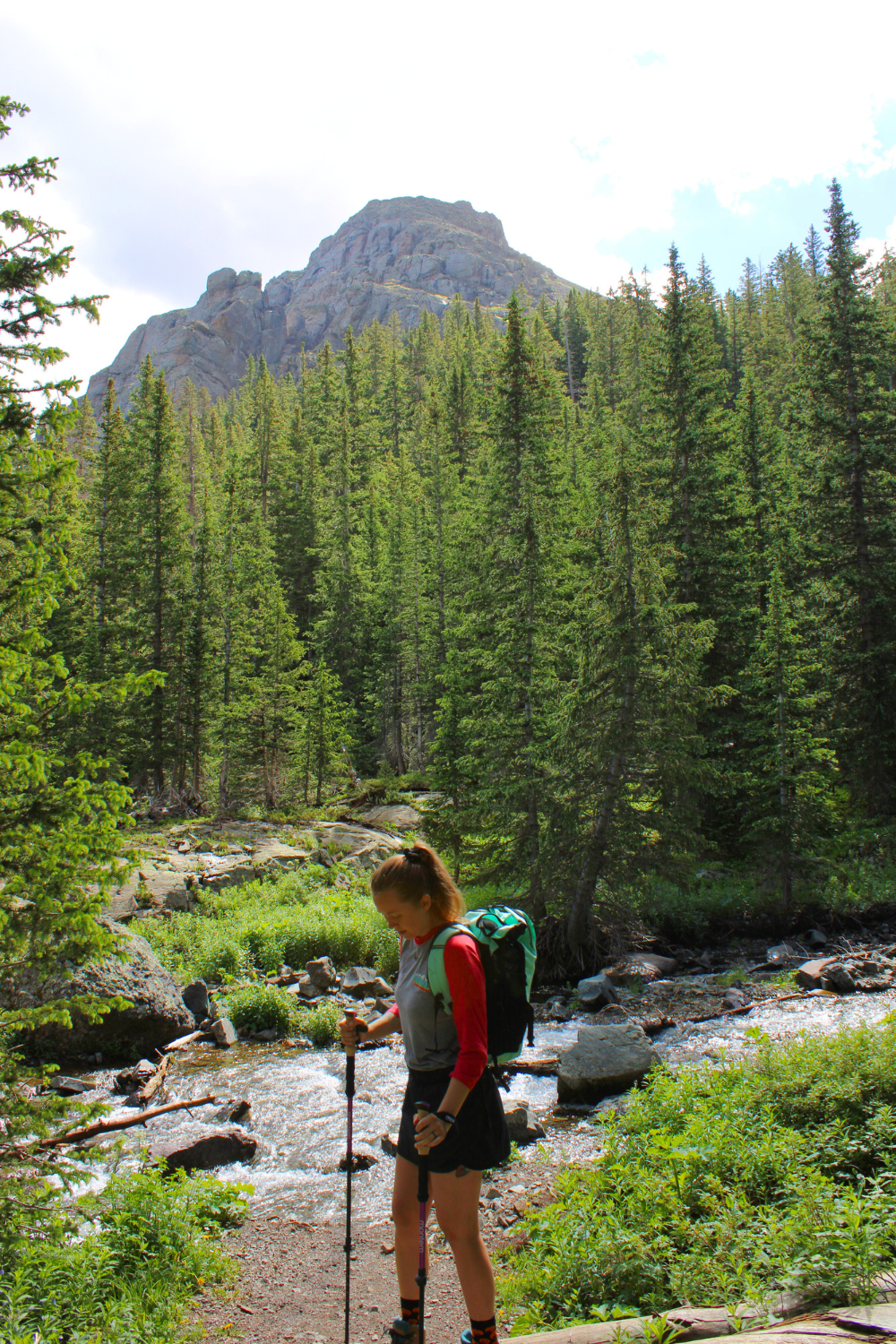
The trail to the Blue Lakes starts in the lush Uncompahgre National Forest with a smooth gradual climb along the East Fork Dallas Creek. Instantly, the trail is stunning with the most rich abundant plant life I’ve ever experienced.
Due to recent rain, there was a mudslide on the path that trail maintenance was working on all day, so it’s a good idea to check for current conditions on AllTrails before setting out on this hike.

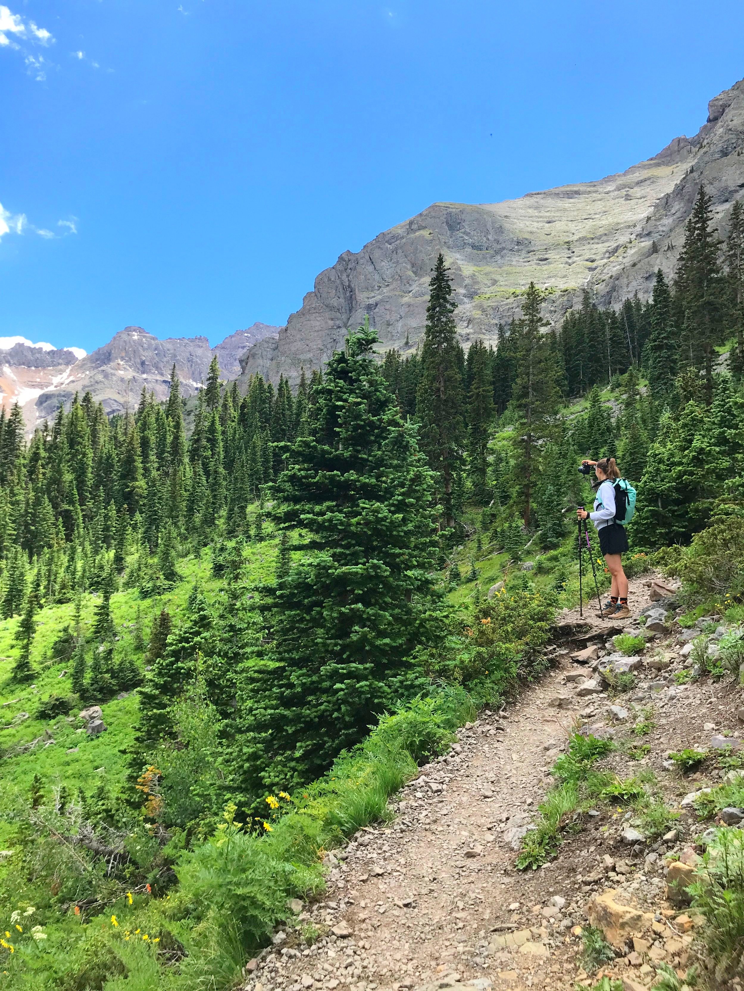
A mile and a half into the trail and 1,000 feet of elevation gain, the trees will part and you’ll enter the Mount Sneffels Wilderness area with Wolcott and Mears Peak towering over 13,000 feet.
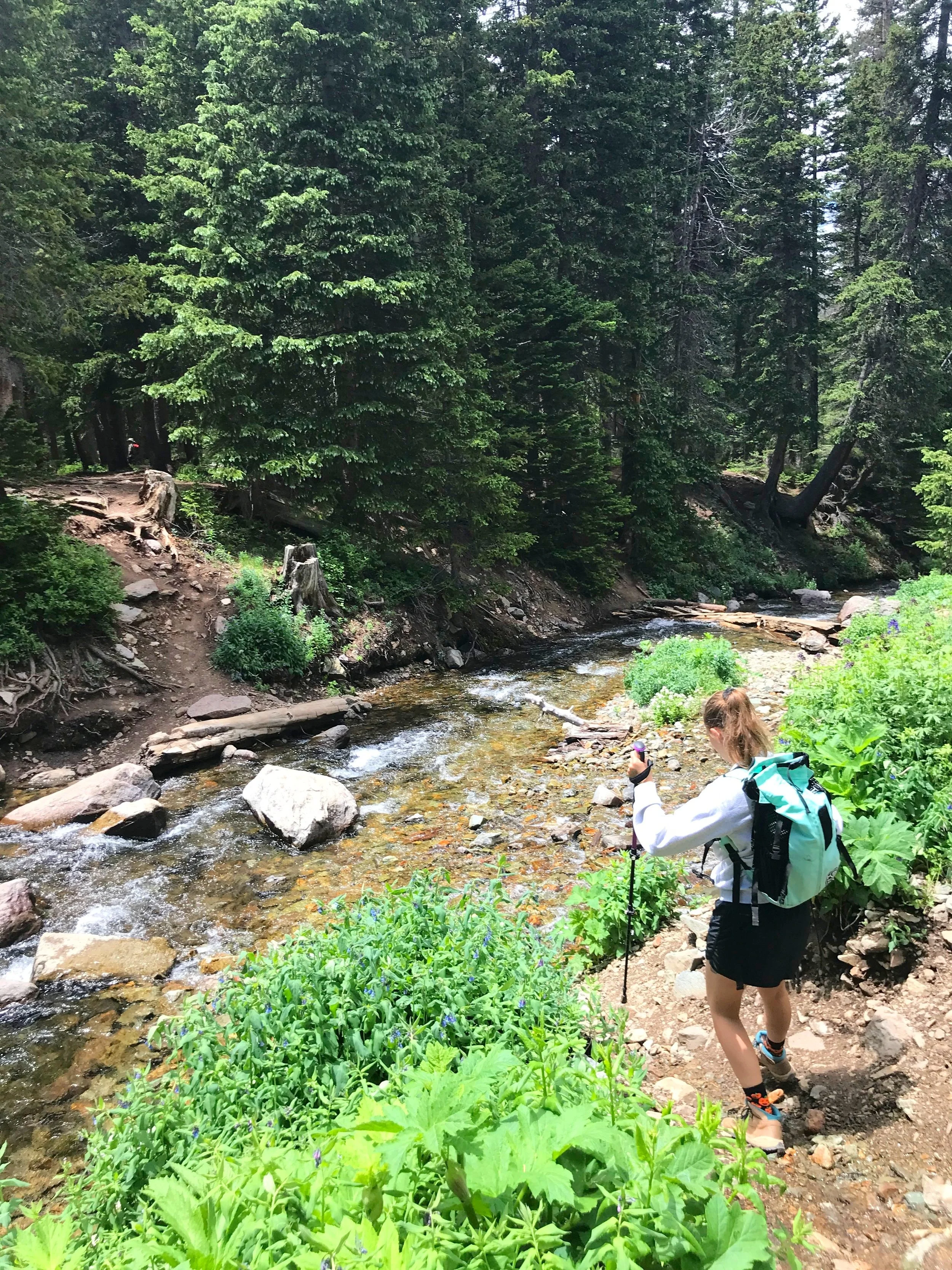
There are two water crossings, both are fairly easy. However, hiking sticks will help a lot in providing support and stability with obstacles all along this trail.

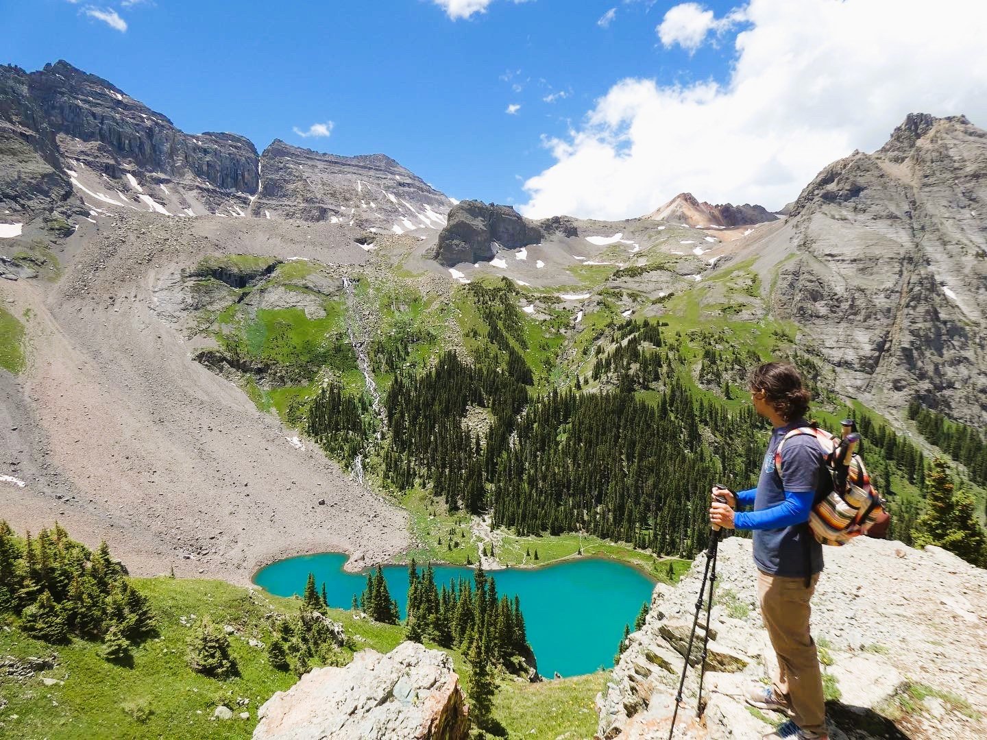
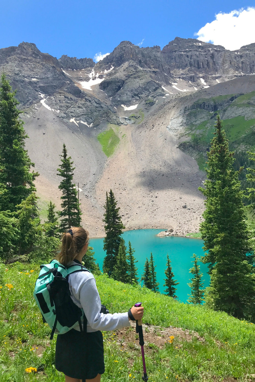
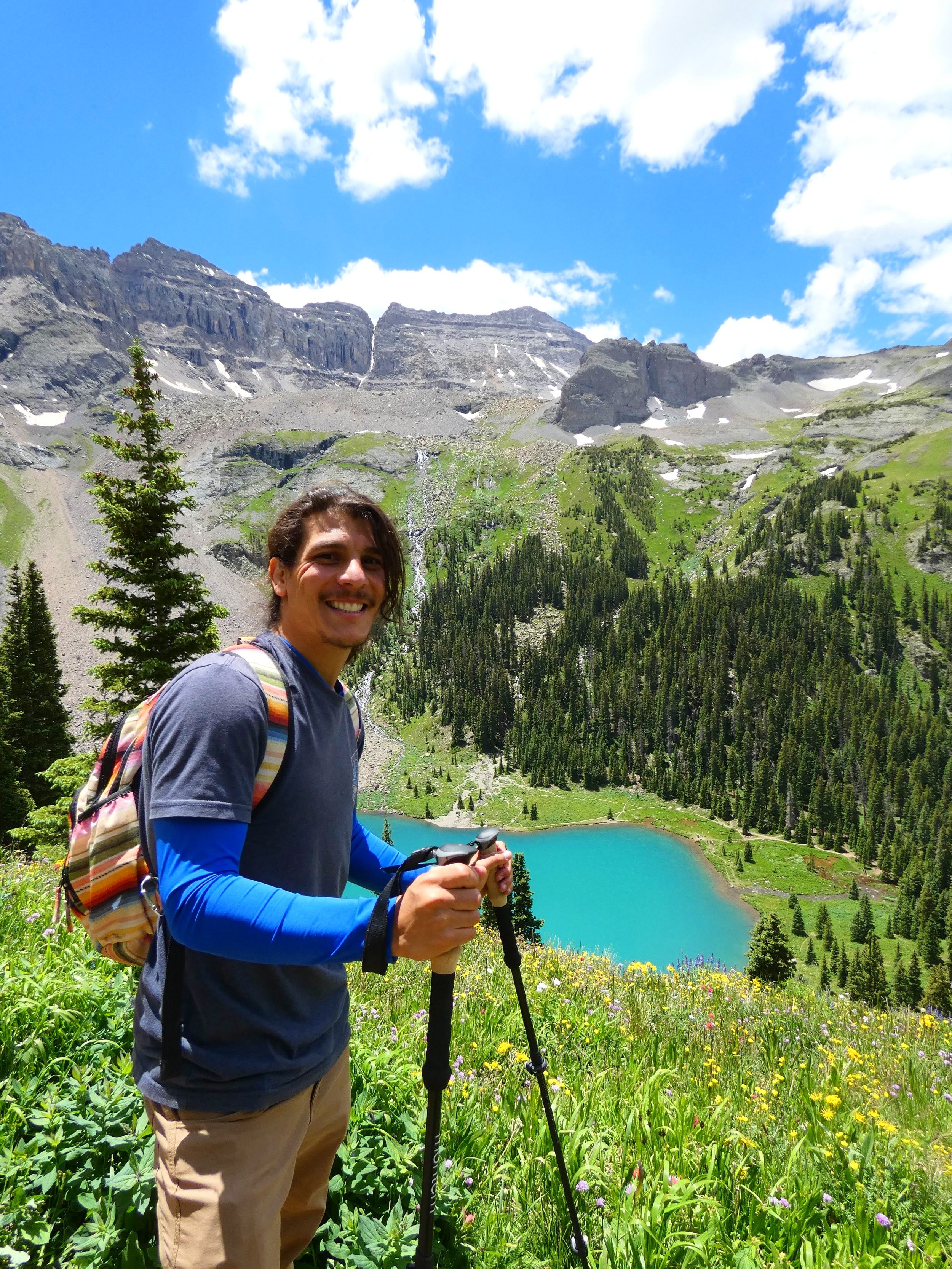
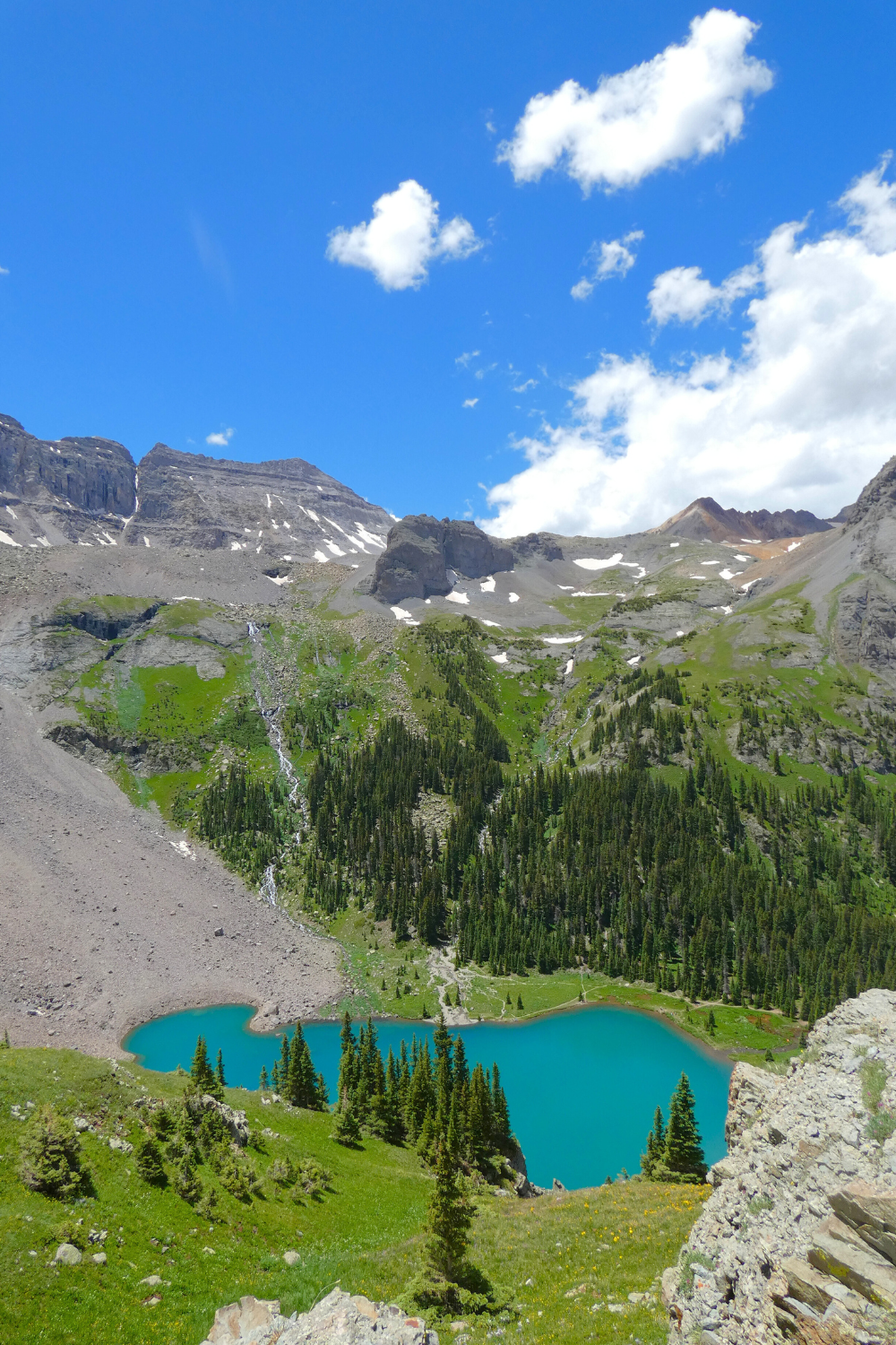
3.3 miles and 1,700 feet later you’ll reach the first blue lake, also known as lower lake. The view is absolutely gorgeous with clear blue water and Dallas Peak soaring in the background, providing a quintessential mountain landscape.
This is a great spot to sit, have lunch, and enjoy the view. For overnight hikers, the Blue Lakes Hut and several campsites are available.


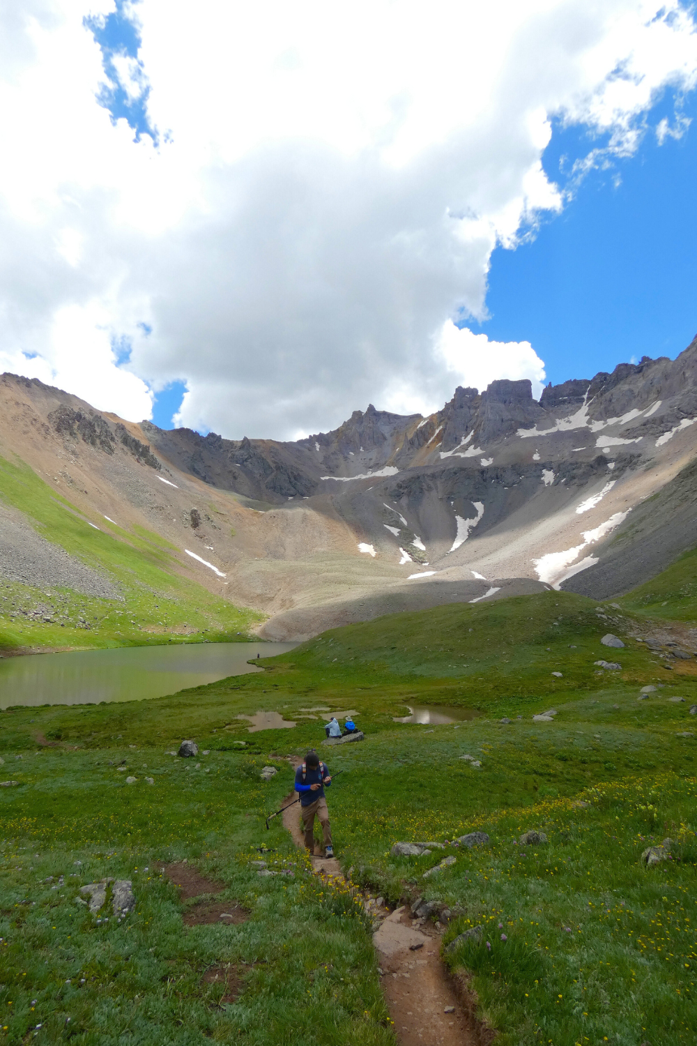
The trail continues on up and around the first blue lake, crossing large rock boulders over the East Fork Dallas Creek. This is the steepest and trickiest part of the hike with 600 feet of climbing in half a mile.
The path becomes hard to follow so we recommend downloading AllTrails or follow some hikers that know the way. Once you get to the top the view is breathtaking.

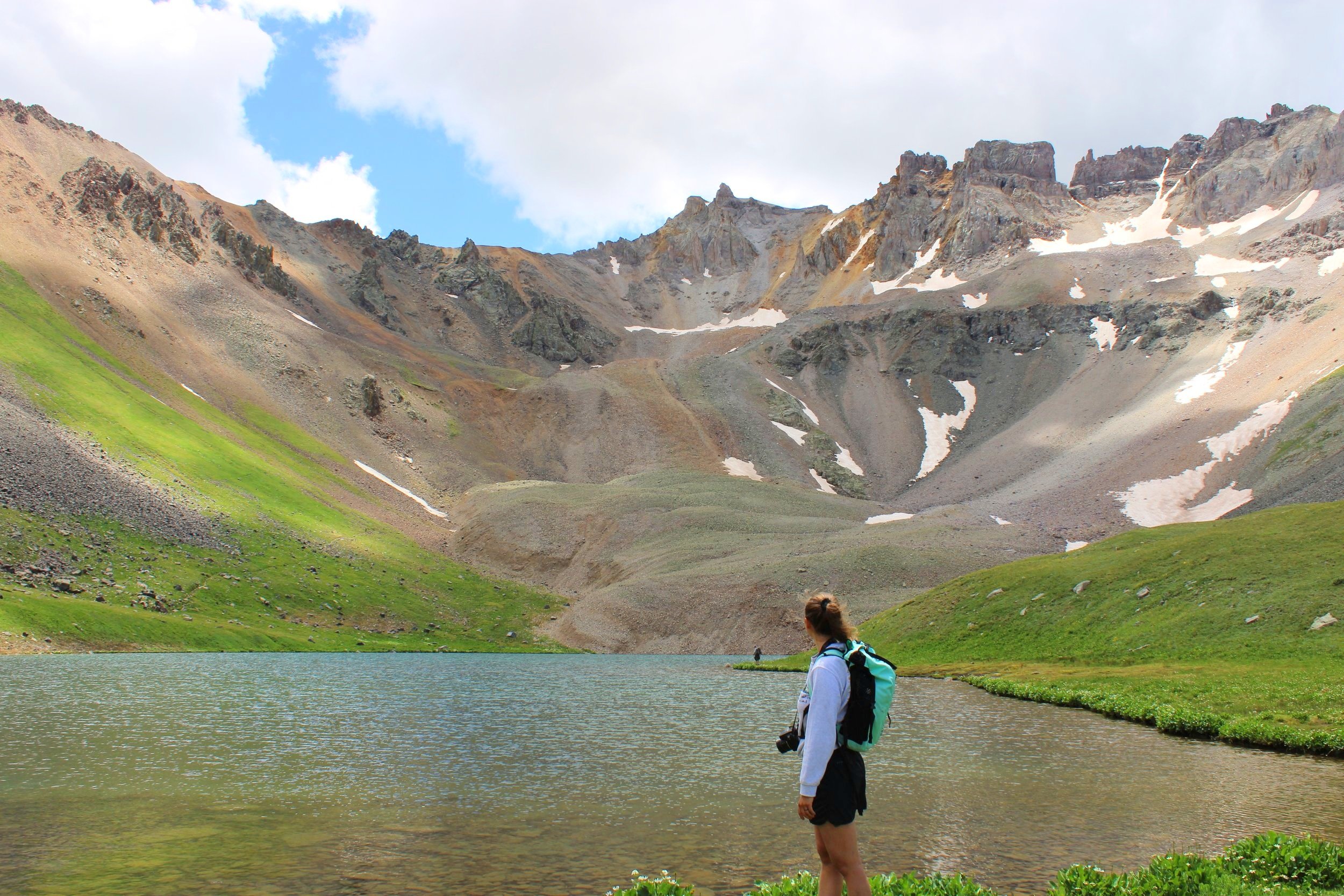
After a short and steep half mile climb you’ll arrive at the second lake also known as middle lake. At this point in the trail, you’ve hiked 3.9 miles and climbed 2,200 feet. The path continues along the middle lake passing colorful blooming wildflowers with unbelievable mountain views.


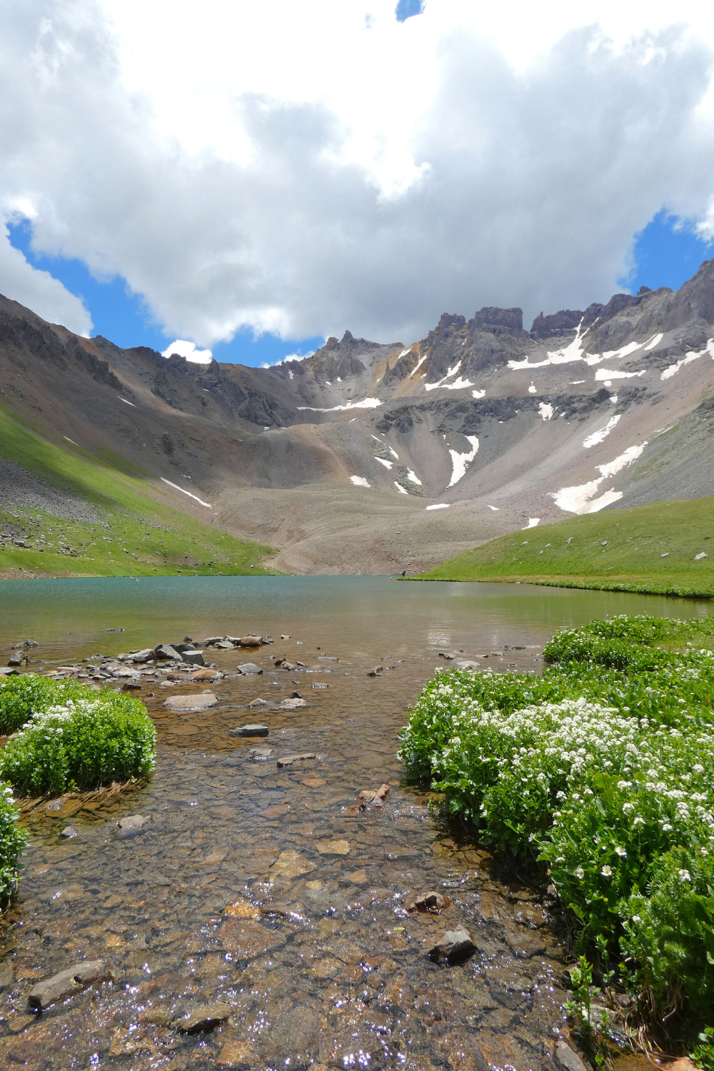
Not long after you pass the middle blue lake will you reach the third lake or upper blue lake at 11,700 feet. You’ll notice the upper blue lake feeds the middle blue lake which meets with the lower blue lake and feeds into the East Fork Dallas Creek. Mount Sneffels is off to the left towering 14,000 feet with Gilpin Peak reaching over 13,000 feet.
Let us know in the comments if you’ve ever hiked the Blue Lakes trail.

That is so nice kids… So you really think it’s the prettiest place you’ve been I’m looking at the pictures and it’s very nice, but I’ve seen some others that you’ve gone to that were just as fab… Enjoy💙😎
That is so nice kids… So you really think it’s the prettiest place you’ve been I’m looking at the pictures and it’s very nice, but I’ve seen some others that you’ve gone to that were just as fab… Enjoy💙😎